Transit

Former Embark CEO leaves Apple nearly three years after acquisition

David Hodge, former Founder and CEO of a company that Apple acquired in 2013 called Embark, announced today on Twitter that he has departed the company. At the time of the acquisition, Embark had transit data on large cities such as Chicago, New York, and San Francisco and had apps considered to be some of the best in their class. This data and the technology used in Embark apps have since helped improve the transit feature of Apple's Maps app.

Sacramento, California gains transit directions on Apple Maps

Having recently rolled out support for transit directions for Sydney Trains in Australia's New South Wales and for buses, subways, commuter rails and other transportation options in Seattle, Portland, Oregon and Montreal, the second-largest city in Canada, the Transit feature is now available to Apple Maps customers who live in Sacramento, California. To use transit directions on Apple Maps, simply enter navigation mode and then tap the Transit button, if available.

Apple Maps adds TrainLink and bus routes for Australia’s New South Wales

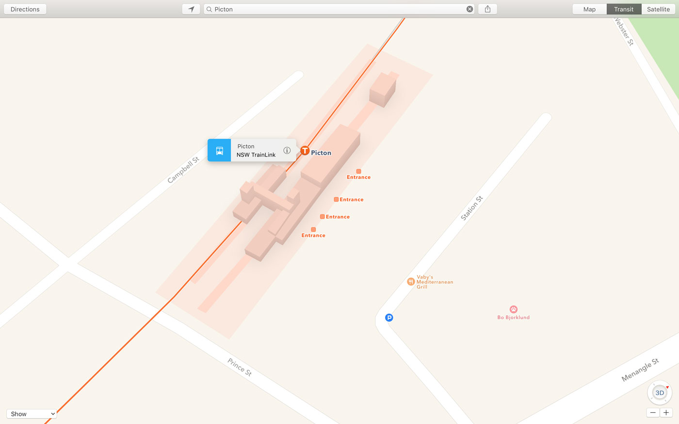
After previously introducing limited transit support for Sydney Trains in Australia, Apple's now expanded transit directions in the country with the addition of TrainLink and bus routes for both Sydney and New South Wales, Mac Prices Australia discovered.

With a silent backend update, Apple Maps customers in New South Wales can now start taking advantage of public transport information for trams, series and interstate services, including buses and trains, while detailing stations with entry points.

Apple Maps gains Transit data for Seattle

After adding transit data last week for public transportation in Portland, Oregon and Montreal, the second-largest city in Canada, Apple on Monday brought Apple Maps' Transit feature to Seattle in Washington.

First spotted by MacRumors, the most recent Transit expansion lets Apple's customers in the city incorporate public transportation options like the Link Light Rail, Monorail, buses and more into Maps when seeking turn-by-turn directions.

Apple Maps Transit data now available in Montreal and Portland, Oregon

Over the past few days, Apple's expanded availability of Transit data on its mapping service to include Portland, Oregon and Montreal, the second-largest city in Canada. Just a month ago, Transit data was added for Austin, Texas, in time for the annual South by Southwest festival.

It also brought 3D Flyover views to five new locales in Germany, Japan and the United Kingdom and expanded the Nearby feature to select new places in Austria, Denmark, Japan and Switzerland.

MasterCard now offering free public transit to Apple Pay users in London

As part of its Fare Free Mondays promotion, global financial services corporation MasterCard is now offering Apple Pay users free public transit in London for a limited time. The promo starts today, November 23, and is valid over the next four consecutive Mondays ending December 14, 2015.

During those Mondays, customers in London can take advantage of Apple Pay on their iPhone 6s, iPhone 6s Plus, iPhone 6, iPhone 6 Plus and Apple Watch to use London's public transit network at no charge. That is, up to £27.90 in daily fares per customer is included in the form of refundable funds.

Boston transit data and Amtrak routes for Northeastern U.S. launch on Apple Maps

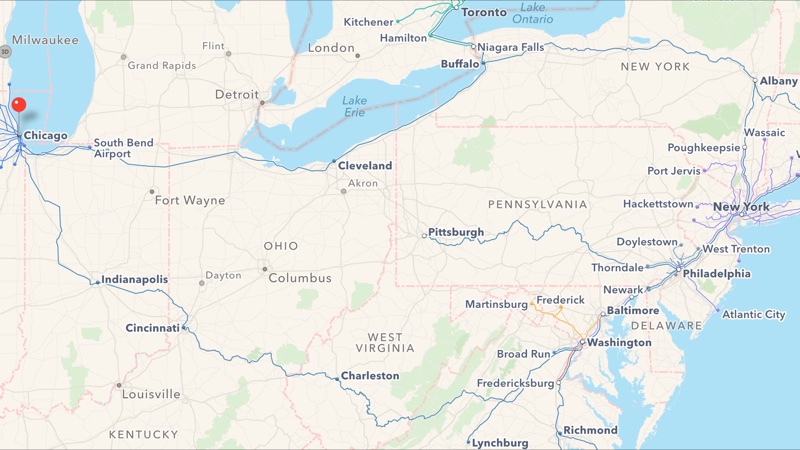
In addition to bringing Yellow Pages-powered business listings to Apple Maps customers in Canada, the Cupertino firm has apparently refreshed a Maps backend in the United States, adding transit directions for Boston and multiple Amtrak routes in the Northeastern United States.

The longest Amtrak route available runs from Chicago to New York. As first noted by MacRumors, other supported routes with transit directions include the Northeast Regional, Acela Express, Keystone, Lake Shore Limited, Pennsylvanian and Maple Leaf.

iOS 9 Maps gives traffic avoidance warnings, transit coverage in Canada better than anticipated

Following Monday's announcement that Maps will gain Transit directions and other new features when iOS 9 launches this fall, some folks are reporting that the feature actually works in even more cities than Apple has said, as discovered by MacRumors.

Not only that but navigating with Maps provides en route traffic and construction warnings, including voice turn-by-turn suggestions for alternate routes, according to information shared with AppleInsider.

Apple Maps gaining public transit directions

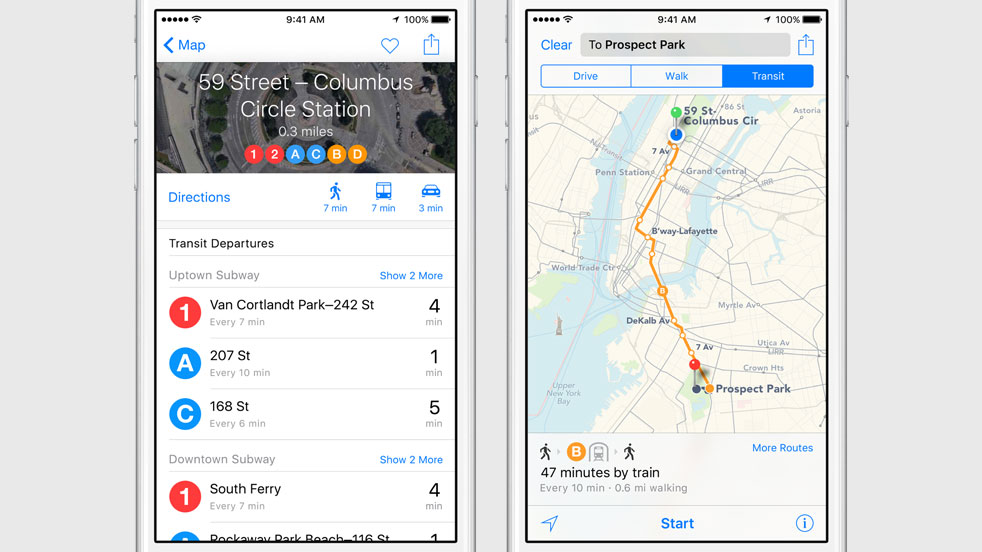
It's transit time! Apple just announced at its Worldwide Developers Conference in San Francisco's Moscone West that its mapping and navigation service will soon provide transit lines, bus stations, ferry lines and more.

Available across Mac, iPhone, iPad and iPod devices, the improved Apple Maps app will sport departure times, multi-modal routing with step-by-step directions, estimated times for walking directions and much more.

Google Maps gains enhanced transit data with live arrivals for buses, metros and subway systems

According to a post on the official Google Lat Long blog, the company's mapping service now includes improved real-time transit information for select cities in the United States, the United Kingdom, Hungary and the Netherlands.

The more accurate transit data includes real-time information on arrivals for buses, metros and subway systems, Google said. Google Maps will even alert you to cancelled routes, so you can “better navigate the intricate and unpredictable world of transit in major cities around the world.”