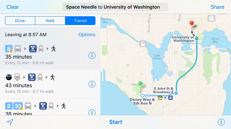
After adding transit data last week for public transportation in Portland, Oregon and Montreal, the second-largest city in Canada, Apple on Monday brought Apple Maps’ Transit feature to Seattle in Washington.
First spotted by MacRumors, the most recent Transit expansion lets Apple’s customers in the city incorporate public transportation options like the Link Light Rail, Monorail, buses and more into Maps when seeking turn-by-turn directions.
Including Seattle, Transit directions were available at the time of this writing in more than sixteen major cities across Apple’s largest markets, including:
- Austin, Texas
- Baltimore, Maryland
- Berlin, Germany
- Boston, Massachusetts
- Chicago, Illinois
- London, England
- Los Angeles, California
- Mexico City, Mexico
- Montreal and Toronto, Canada
- New York City, New York
- Philadelphia, Pennsylvania
- San Francisco, California
- Sydney, Australia
- Washington, DC
With the Transit feature, iPhone, iPod touch, iPad and Mac users can use the stock Apple Maps application to check out departure times, routes and other information pertaining to buses, trains, ferries and other forms of public transportation.
Transit information was first added to Maps with the iOS 9 debut in September 2015.
The official iOS 9 Feature Availability webpage breaks down Apple’s services, including Maps’ features like Transit and Flyover, by regional availability.
Source: MacRumors