Maps

Apple Purchases Another 3D Mapping Company

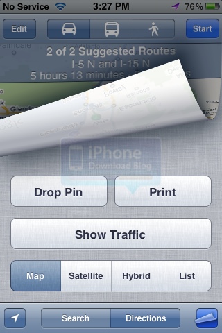
Aside from small additions like displaying alternate routes and the Show Traffic option, the Maps application received little attention from Apple during the recent iOS update. Some pundits expected the app to at least receive turn-by-turn directions.

But a revamped Maps app might still be in Apple's plans. 9to5Mac is reporting that Apple has just quietly acquired "mind-blowing 3D mapping company" C3 Technologies, and that the Cupertino company is looking to take iOS maps to the next level...

Apple Working On Turn-By-Turn Navigation in iOS

A new job listing uncovered by AppleInsider hints that Apple is focusing on the enhancement of location-based applications in future versions of iOS. For location-aware apps on the iPhone, Apple is looking to hire a talented "iOS QA Location Engineer" with a focus on GPS technology.

It's been rumored that Apple is working on a better Maps app for iOS, and this new job listing further corroborates that speculation.

DashBoard for Maps Brings Heads-up Display to the Maps App

Over the last few weeks, we've seen an increase in interest from jailbreak developers regarding the iOS Maps application. We've seen Speed for Maps, which adds a speedometer to the Maps app, and a Compass tweak that does the same thing.

Now there's is a utility available that will not only tell you how fast you are going and where you're headed, but also display your elevation. It's called DashBoard for Maps, and it just went live in Cydia...

Apple Working on Augmented Reality for Maps App

There's been a lot of evidence over the last few years that Apple is working on drastically enhancing the Maps application in iOS. From job listings, to the acquisition of mapping companies like Placebase and Poly 9, it's not hard to follow the breadcrumbs.

Fast forward to today, and reports are surfacing that suggest that Apple is taking their research to the next level. MacRumors has uncovered a new patent application from the Cupertino company that describes mapping software with augmented reality functionality...

Compass for Maps Fleshes Out the iPhone’s Stock Maps App

Last week we showcased Speed for Maps, a Speedometer jailbreak add-on for the iPhone's stock maps app. This week, the same developer has followed up with a sequel of sorts, a compass add-on that looks and feels just like his previous work.

The main difference here, is that you must use an iOS device equipped with a digital compass. In other words, when it comes to the iPhone, only the iPhone 3GS and the iPhone 4 qualify.

Check inside for a video demonstration of Compass for Maps in action...

Jailbreak Tweak Adds Speedometer to Your Maps App

The jailbreak community is responsible for creating many extremely useful utilities for our iDevices. This however, is not one of them.

Speed for Maps more likely falls in the "Hey, that's kind of cool" category. This new jailbreak tweak installs itself in your native Maps application, and it places a speedometer in the bottom right corner...

Stolen iPhone’s Journey Seen Through the Eyes of a Getaway Car

We've told you plenty of interesting stories that involve thievery and the iPhone. This one is no exception.

Sue Huang's iPhone was taken, and she finally got it back five days later after the thief ransomed it back to her. Thanks to the iPhone's GPS, Sue and her friend Brian were able to recreate where her iPhone had been during the five days that the thief drove around with the device in his car.

They stitched together a video of the stolen iPhone's Google Street View location as it moved throughout the city of LA during a period of five days...

TryGpsOut: Turn Your Wi-Fi iPad into a Digital Map

The jailbreak community is responsible for a number of iDevice enhancements and innovations. Jailbreak developers are constantly giving our iDevices features that Apple for one reason or another has left out.

A perfect example is BTStack GPS. The utility allows you to connect an external GPS unit to your iPad to use with mapping software. Don't own an external GPS unit? The community's got you covered there too. A new app called TryGpsOut will allow you to use your iPhone instead...

Evidence Surfaces in iOS 5 that Apple is Still Working on Maps App

I have to admit, after all the evidence we've seen over the last several months, I was a little surprised that we didn't see any kind of major improvements to the Map app in iOS 5. Apple has purchased multiple GPS software companies in the last few years, including PlaceBase and Poly9.

But even though there were no significant Map announcements at WWDC, there's still hope. Apple's developer's conference only gave us a "sneak peak"  at 10 items from a list of over 200 improvements, so it's very possible that we may still see Maps get a revamp this fall...

New in iOS 5: Print Maps Directly from Your iPhone

A new feature in iOS 5 allows you to print maps direction directly from your iPhone, assuming your have a Wi-Fi-friendly printer of course. I didn't pay much attention to this feature until I actually tried it.

In order to print directions, tap the little icon at the bottom right of the Maps app. You will then be given several options, the "Print" one included...

New in iOS 5: Suggested Routes in Maps

If you go to the Google Maps website and look for directions to a specific location, chances are there are different ways to get there. This is what Google calls "suggested routes." The website lets you easily see those alternate routes and you can select the one that fits you best.

"Suggested Routes" is a new feature in the Maps app of iOS 5. Just like Google Maps on the web, the app will offer you suggested routes if available...

Brilliant Marketing: Apple’s $1 Billion Data Center Magically Appears on Google Maps

Up until today, if you looked for Apple's billion dollar data center in North Carolina on Google Maps, you could not find it. The location was there but it just showed some farmlands and nothing much around.

Things have changed. As of now, you can see Apple's North Carolina data center on Google Maps, and it seems to be one of the latest satellite images of it. So why didn't this data center show up on Google Maps before?