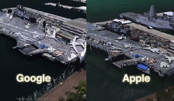
Google, in an attempt to outshine one of the worst kept secrets in the industry at the time — Apple’s 3D Maps announcement at WWDC 2012 — hastily put together its own presser 5 days in advance, to announce their entry into the “next dimension” of maps.
That’s all water under the bridge now (see what I did there?), and both companies have 3D technology incorporated in their apps — Google, with Google Earth, and Apple, with Maps for iOS 6.
Obviously Apple’s maps update is still in beta, and Google just recently released their Google Earth upgrade, but which 3D building implementation looks better up to this point? The answer might surprise you…
The video comparison
[tube]http://www.youtube.com/watch?v=_7BBOVeeSBE[/tube]
Let’s look at the statistics up to this point:
From what I’ve been able to gather, Google Earth features 3D building support for 2 continents, North America, and Europe, for a total of 13 locations.
United States
- Boulder
- Boston
- Charlotte
- Lawrence (Kan.)
- Long Beach
- Los Angeles
- Portland
- San Diego
- Santa Cruz
- Tampa
- Tucson
- San Francisco and the Bay Area
Europe
- Rome, Italy
Apple, on the other hand, supports 3D buildings on 3 different continents, for a total of 26 locations. That’s double the amount of locations contained within Google Earth.
United States
- Atlanta
- Boston
- Chicago
- Dallas
- Denver
- Houston
- Las Vegas
- Los Angeles
- Memphis
- Miami
- New Orleans
- Philadelphia
- Phoenix
- Portland
- Sacramento
- San Diego
- San Francisco and the Bay Area
- Seattle
Canada
- Toronto
- Montreal
Europe
- Birmingham, UK
- Manchester, UK
- Copenhagen, DK
- Lyon, France
Australia
- Sydney
- Melbourne
As you can see, not many cities receive the 3D building treatment from both companies, but there are a few notable exceptions: Boston, Los Angeles, San Diego, and San Francisco.
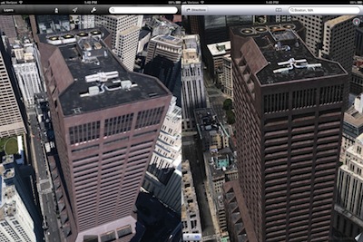
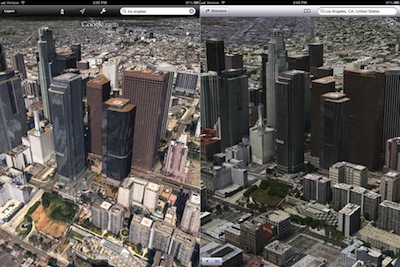
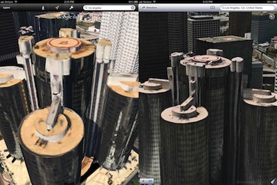
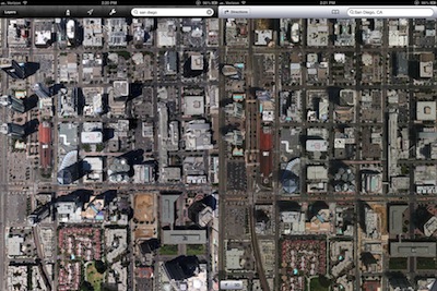
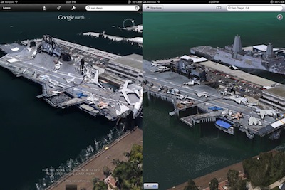
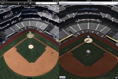
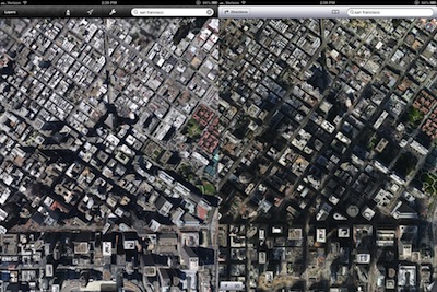
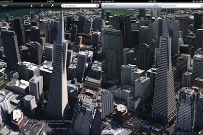
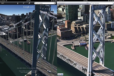
With this in mind, I decided to compare each of the four cities at varying levels of zoom — far, midrange, and close. What you’ll undoubtedly notice, is that Google’s mapping textures pale in comparison to the textures used by Apple. For each of the four cities listed above, the 3D buildings showed a significant graphical difference in favor of Apple.
Some of the textures featured in Google Earth were so bad, that they harken backed to Nintendo 64 days when it comes to texture detail. If you were a gamer back in the late 90’s, then you know exactly what I’m referring to — the washed out look that infamously plagued many of the console’s games.

That’s not Google Earth’s 3D buildings, that’s GoldenEye for the N64.
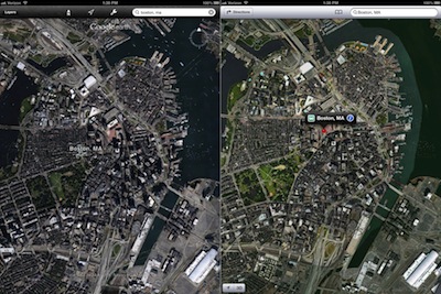
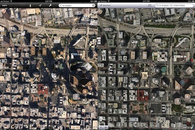
Let’s take a look at each city one-by-one. We’ll start with Boston. Please note that Google Earth is located on the left, and Apple Maps are on the right. Be sure to click the images to see the higher resolution comparison, as the thumbnails below don’t do it justice.
Boston
Los Angeles
San Diego
San Francisco
Granted, all of this is subject to change, as iOS 6’s maps app is still in beta, and Google Earth was just recently updated with 3D buildings. What we can glean from this, though, is that Apple was smart to snatch up startup Poly9 (three-dimensional rendering) and mapping experts C3 Technologies (rapid 3D mapping). It’s pretty remarkable that someone like Google, who’s been at this stuff for years, can be out-shined so quickly. It goes to show you how good Apple is at investing and evaluating talent.
While Apple’s Maps certainly look better, I’ve concluded that it lags behind from a performance standpoint. Keep in mind that Apple’s Maps are still in beta, so this will likely change. At the moment, though, it doesn’t appear that the 3D map data is cached on the device to the same degree as it is on Google Earth, as many times when you zoom out of an area, and then zoom back in, you’re greeted with the large checkerboard of doom. This could also be impacted by the fact that the textures are of such high quality, and it takes more time to download them than it does on Google Earth. I’m not sure how big a data file would have to be to contain an entire city, but I’d imagine that it’s of decent size.
Google Earth, on the other hand, is a bit smoother in operation at the moment. Zooming in and out seems more fluid, but again, this probably has a whole lot to do with the size of its texture files, caching, etc. At the end of the day, Apple’s maps are bound to perform just as buttery once completed, especially on a device like the new iPad.
Both apps are definite steps in the right direction. It’s hard to convince people how amazing 3D maps are until they’ve seen it for themselves. Whichever 3D mapping tech you end up using, it’ll still be miles ahead of anything offered in the past. What do you think?
Note: All screenshots and video taken from the new iPad running iOS 6 beta 4.
