The Apple Maps web app now supports Look Around, a Google Street View-like feature that provides high-resolution ground imagery.
Apple Maps on the web gains Google Street View-like Look Around feature

The Apple Maps web app now supports Look Around, a Google Street View-like feature that provides high-resolution ground imagery.
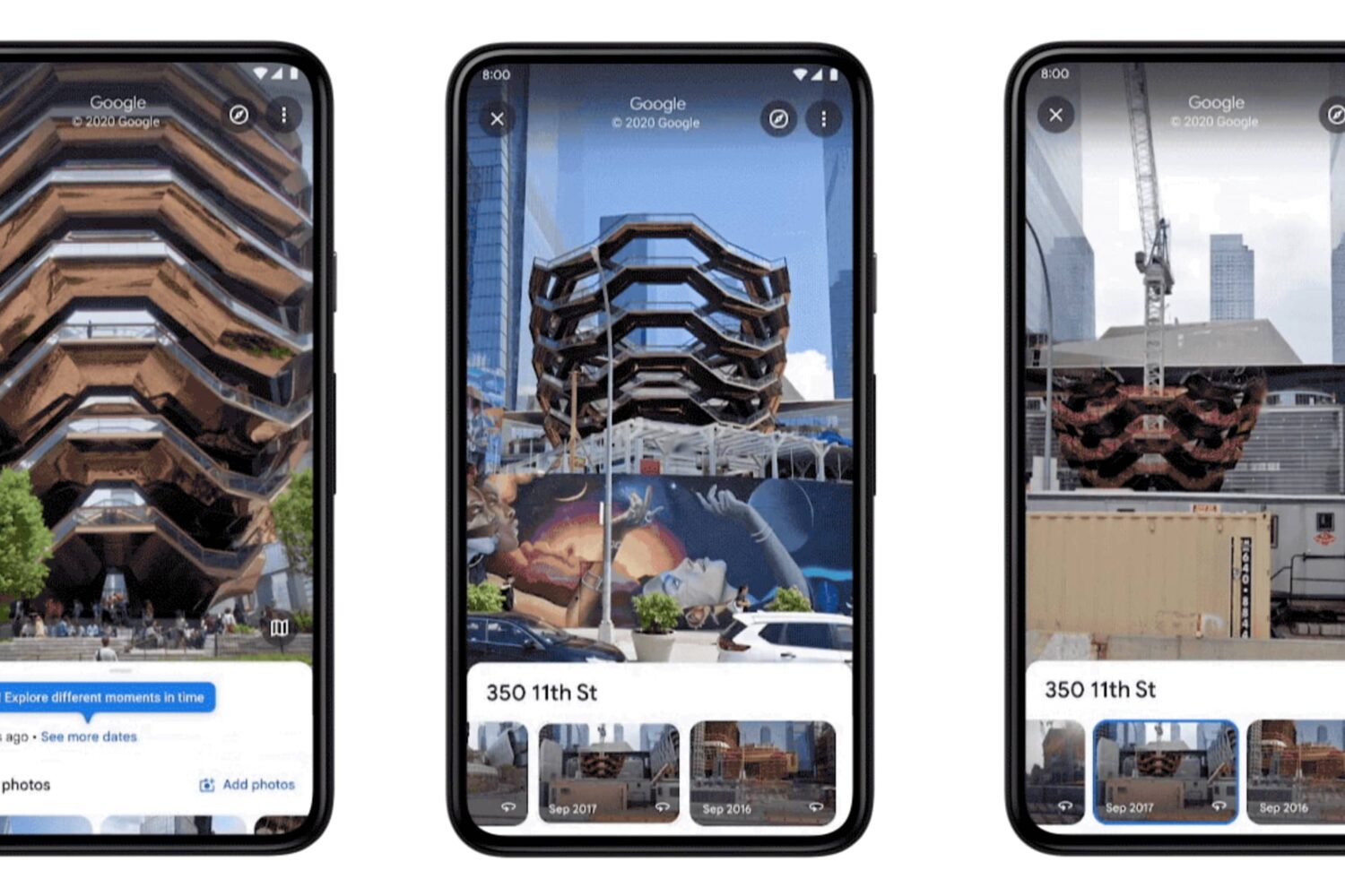
Google Maps is bringing a historical Street View feature to its mobile app, meaning you can now see older street-level photography captures from as far back as 2007.

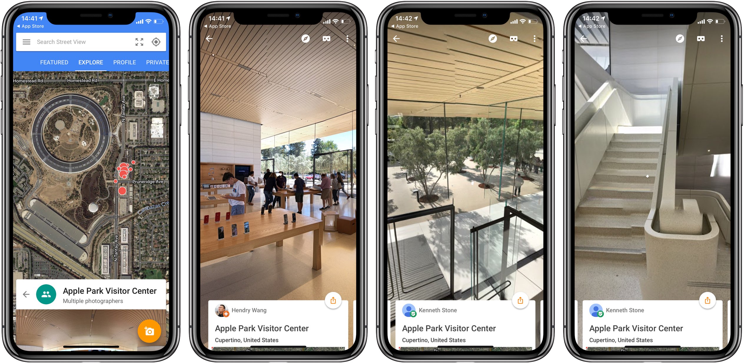
iOS 13 has brought detailed street view imagery to Apple Maps thanks to the company's LiDAR-outfitted vehicles that have been roaming the streets of major cities in the US and around the world for years now, dutifully capturing high resolution street-level imagery.
Google's finally updated the Street View iOS app with support for native resolution on the handset's edge-to-edge Super Retina display. With today's update, the app no longer shows the horizontal black bars that appear when running unoptimized apps on an iPhone X.
If you've been wondering why Apple Maps isn't getting any outward-facing enhancements in iOS 12, here's your answer: the company has been busy working on a massive Maps update.

Google on Tuesday announced that the popular street-level photography feature available on its Maps service now covers eleven Disney-operated theme parks in the United States.

2017 marked the tenth anniversary of Street View, a technology featured in Google Maps and Google Earth that provides panoramic views from positions along many streets in the world.
Google is upgrading the quality of aerial imagery for the satellite view that's available in Google Maps and Google Earth services. According to a blog post yesterday, both mapping services now offer crisp high-definition satellite imagery of Earth without clouds captured by Landsat 8, an Earth observation satellite launched on February 11, 2013 in a collaboration between NASA and the United States Geological Survey (USGS).
Google's native mapping application for the iPhone, iPod touch and iPad was bumped to version 4.19 this morning, bringing out a few enhancements meant to improve your navigation and Street View experience.
For starters, a few new voice controls are now available in navigation to mute, unmute or turn on alerts only. You can also move around Street View by swiping, and more.
A month ago, Google promised to release a standalone Street View mobile app “early next month.” Today, the Internet giant has made good on that promise as the all-new Google Street View app just hit the App Store (actually, it soft-launched in August 2014, but today's update feels like a whole new app and anyone can use it now).
Available for the iPhone and iPod touch, it lets you browse and enjoy Google's awesome street-level photography.
With this software, you can move and pan around by dragging your finger on the screen and even upload your own 360-degree photography to Google Maps to share your photo spheres with the world.
Two months ago, Google hinted it was readying a brand new mobile application called Street View. The app was designed to provide easy access to your photo spheres and those from Google and other contributors. Today, the Internet giant sent an email blast confirming that the native Street View for iOS app is coming in early-September.
The search company did not share detailed information about the upcoming software, but we've been able to glean a few tidbits. For starters, the Street View app will replace Google's Photo Sphere Camera mobile app for iOS and Android. More important than that, Street View will be capable of linking to a dedicated spherical camera hardware.
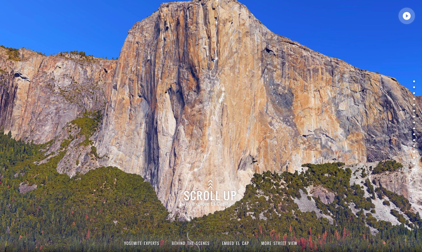
Yosemite National Park's El Capitan isn't just the world’s most famous rock wall, but the official name of Apple's latest desktop operating system, too. Coincidentally or not, Google Maps has teamed up with legendary climbers Lynn Hill, Alex Honnold and Tommy Caldwell to capture an awesome panorama tour of El Capitan's epic 3,000 feet climb.
You can explore it inside your browser with Google Maps' marvelous vertical Street View mode offering high-quality 360-degree photography of the rocks from the climbers' perspective that can be rotated and panned around.