Update your iPhone to iOS 18.3 to use carrier-provided satellite connectivity like T-Mobile's Starlink in areas without cellular service or Wi-Fi coverage.
iOS 18.5 lets iPhone 13 owners use carrier-provided satellite connectivity
Update your iPhone to iOS 18.3 to use carrier-provided satellite connectivity like T-Mobile's Starlink in areas without cellular service or Wi-Fi coverage.
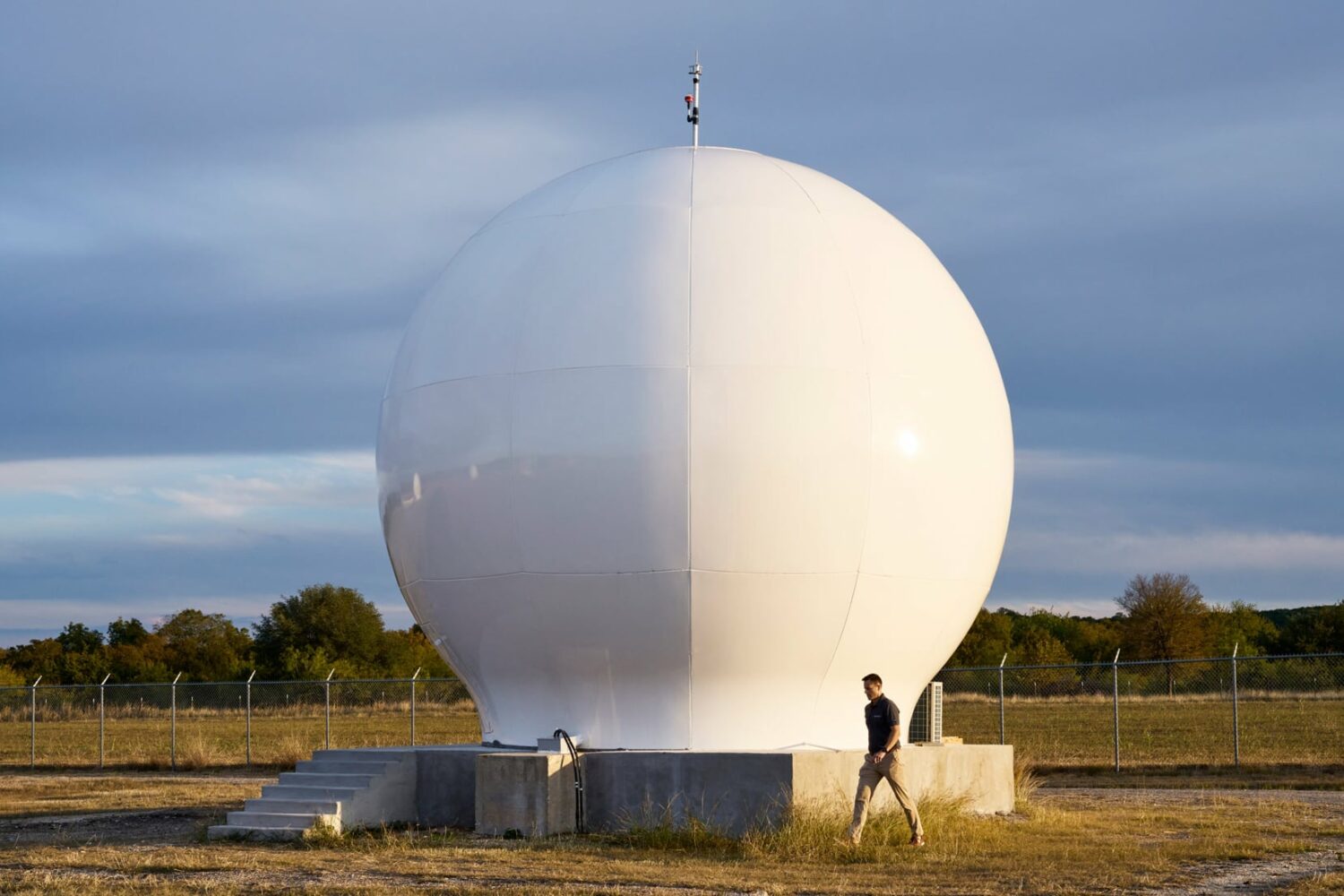
SpaceX tried stalling the expansions of the iPhone’s satellite connectivity by lobbying the FCC to block the launch of a new satellite constellation by Apple's partner.

iOS 18.3 brings support for iPhone owners on T-Mobile to connect to Starlink satellites thanks to a partnership between Apple and SpaceX.
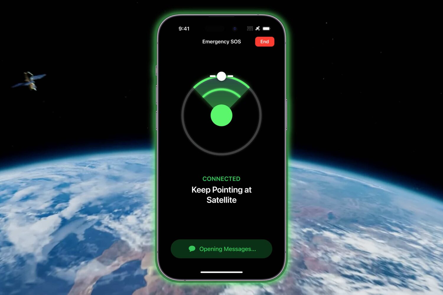
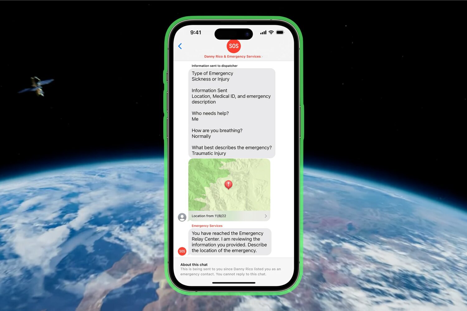
Starting with the launch of the iPhone 14 lineup one year ago, Apple introduced a revolutionary feature called Emergency SOS via satellite that allowed users to request help when outside of ordinary cellular signal range.
Apple's customers who live in Australia and New Zealand can now take advantage of Emergency SOS via satellite when cellular and Wi-Fi coverages are unavailable.
Customers in Austria, Belgium and four other European countries can now use Apple's Emergency SOS via satellite feature as long as they've updated to iOS 16.4.
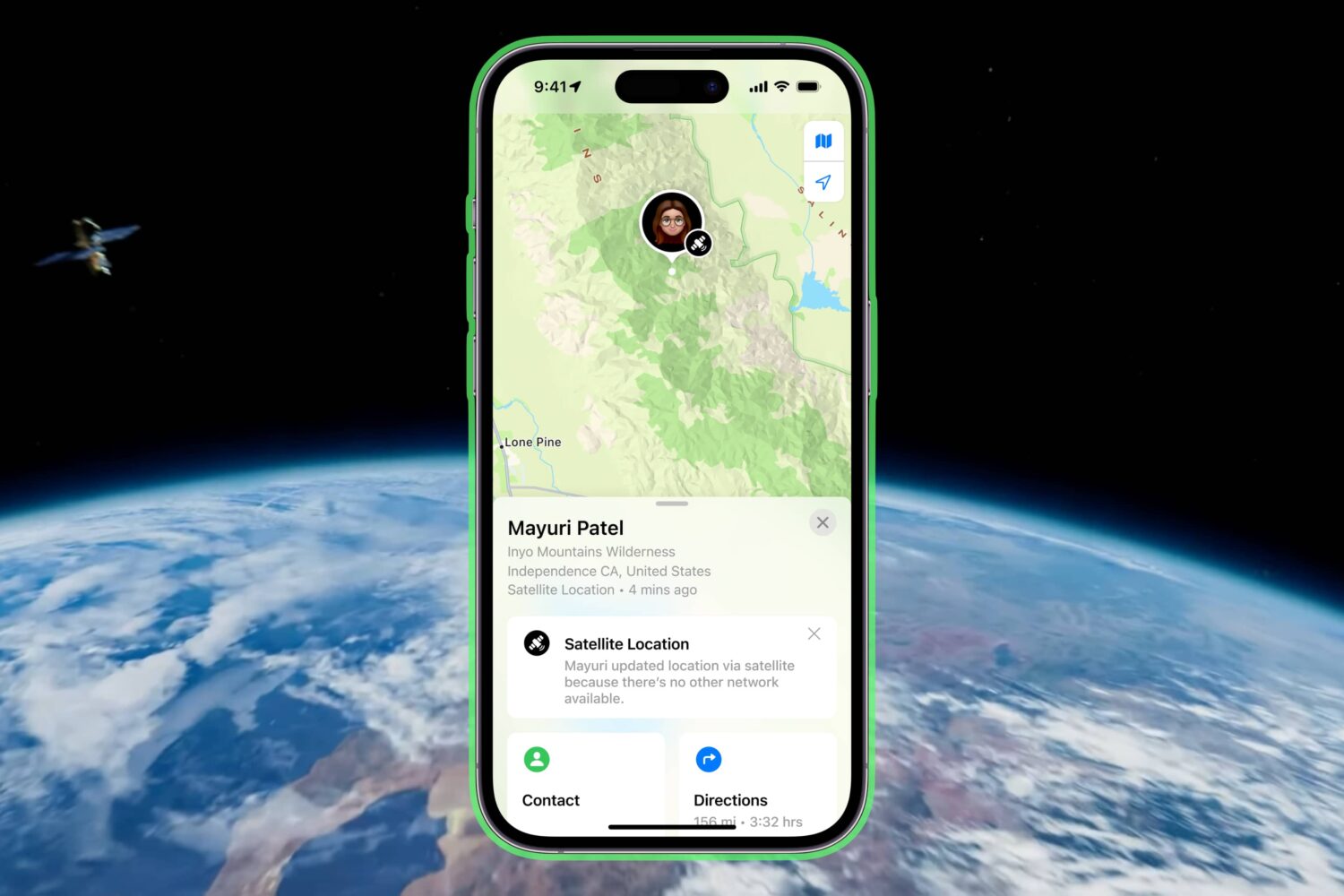
Take advantage of satellite connectivity to share your precise location via satellite using Apple's Find My app and your iPhone 14 or iPhone 14 Pro.

This year's upcoming iPhone 14 models is rumored to add satellite connectivity for SOS response features and emergency contacts anywhere there's satellite coverage.

iPhone satellite communication features are thought to be limited to emergency uses, with support for the rumored capability understood to be limited to certain markets.
Apple has reportedly tasked its secret team of satellite and wireless technology experts with findings solutions for an alleged satellite broadband service which would beam data and provide Internet connectivity directly to its devices, bypassing the traditional carriers.