Apple continues to expand enhanced Maps across the United States, with more detailed mapping data now live in West Virginia, Ohio, Michigan, Indiana and North Illinois.
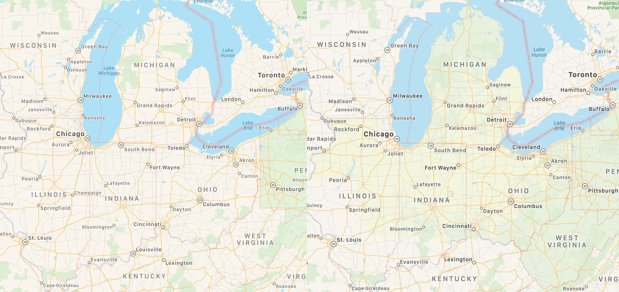
According to Reddit, via MacRumors, the Midwest maps comparison top of post shows the difference between the old Maps data and the newly enhanced Maps in the aforesaid regions.
To get a better view of updated terrain data, find a supported region in Apple Maps on your iPhone, iPad or Mac and zoom in until you see previously-unavailable detail such as sports fields, parking lots, ground cover, foliage, pools and pedestrian pathways.
Maps data is collected by Apple’s sensor-equipped vehicles. Enhanced terrain data in Maps should cover much of the United States before 2019 wraps up, Apple promised at WWDC 2019, with further expansions scheduled to kick off in other countries beginning 2020.
Northeast U.S. recently gained more accurate Maps data, including Washington DC, Maryland, Pennsylvania, New York, Massachusetts and Maine. Better maps from Apple are also available in Texas, Louisiana, Southern Mississippi, Hawaii, Southern California, Arizona, New Mexico, and the Las Vegas metropolitan area.
Northern California is the first region to get enhanced Maps in July 2018.
iOS 13 and iPadOS brought out many noteworthy Maps improvements like Collections, Favorites, junction views in China, real-time transit, flight status, better Siri guidance, the ability to share your ETA with friends and a street-level photography feature, called Look Around.