The Landmarks app lets you explore a curated collection of more than 300 custom-designed 3D models that are available on Apple Maps, organized by city.
The Landmarks app showcases all 3D models currently available on Apple Maps
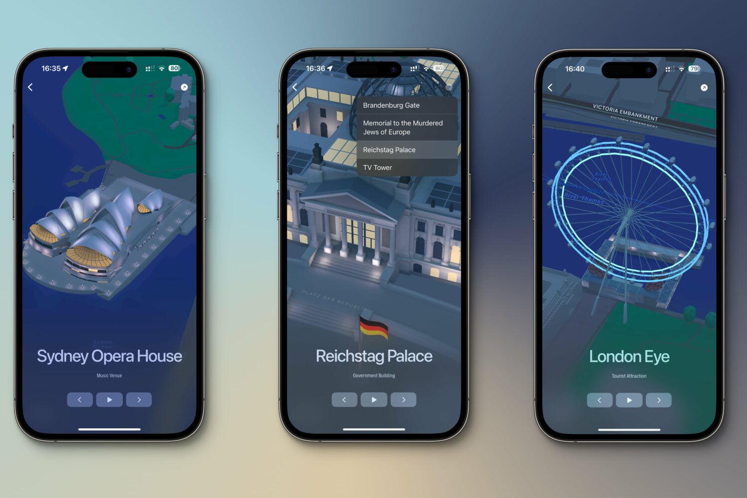
The Landmarks app lets you explore a curated collection of more than 300 custom-designed 3D models that are available on Apple Maps, organized by city.
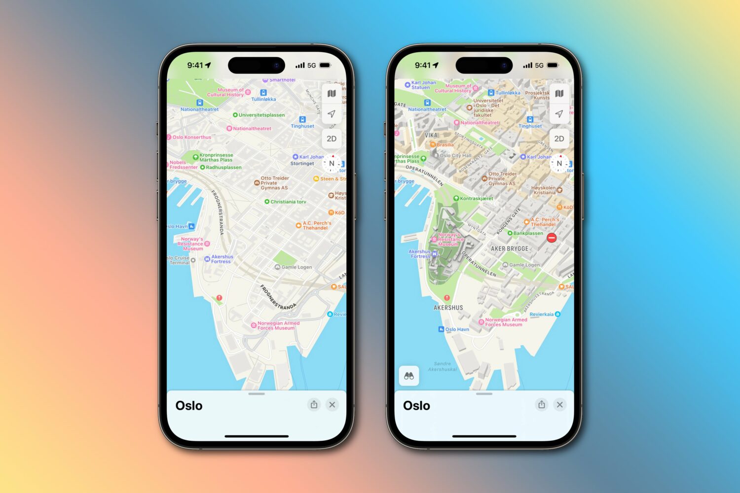
For the first time, customers in Finland, Norway and Sweden can enjoy Apple Maps enhancements such as Look Around, AR navigation, 3D views, etc.

Track your journey, get updated ETAs and see where to make your next trip with Google Maps—right on your iPhone’s lock screen, without opening the app.
iPhone and iPad users can now search for and reserve nearby parking without leaving Apple Maps, with Mac integration on the way.

Google Maps has launched new features, including location-sharing alerts for arrival and departure times and photorealistic 3D aerial views of famous landmarks.
Overhauled Apple Maps is live in France, Monaco and New Zealand, based on Apple's own mapping data which it began collecting back in 2018.
The mobile Google Maps app now estimates toll charges for your journey, which allows you to plan ahead by seeing how much you'll need to pay in route tolls.
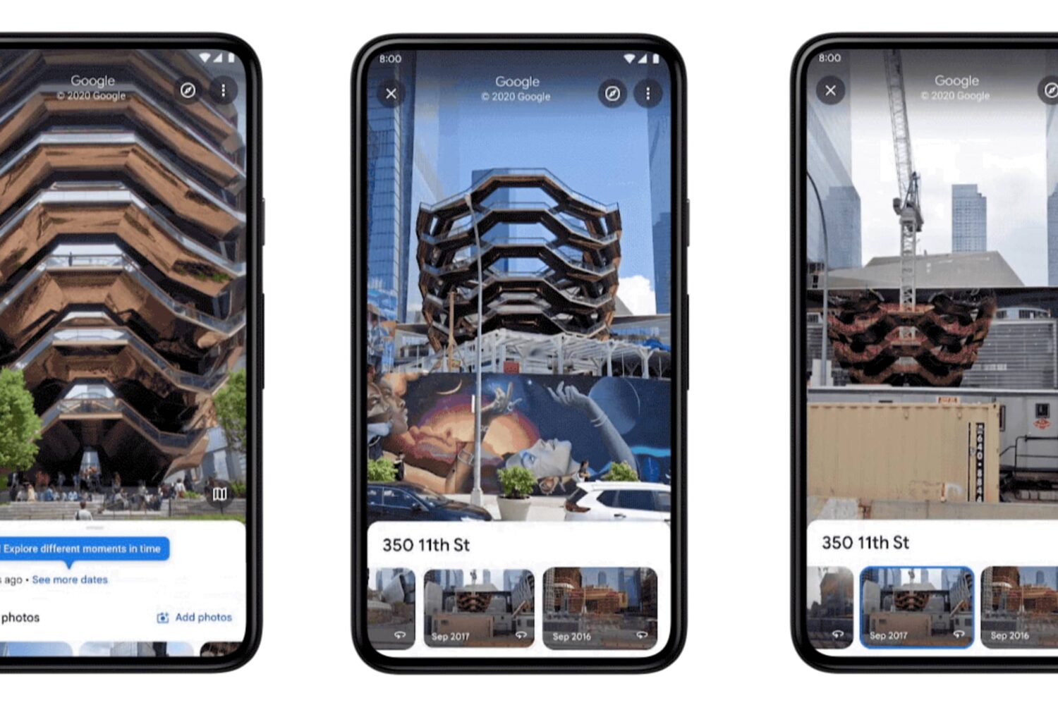
Google Maps is bringing a historical Street View feature to its mobile app, meaning you can now see older street-level photography captures from as far back as 2007.
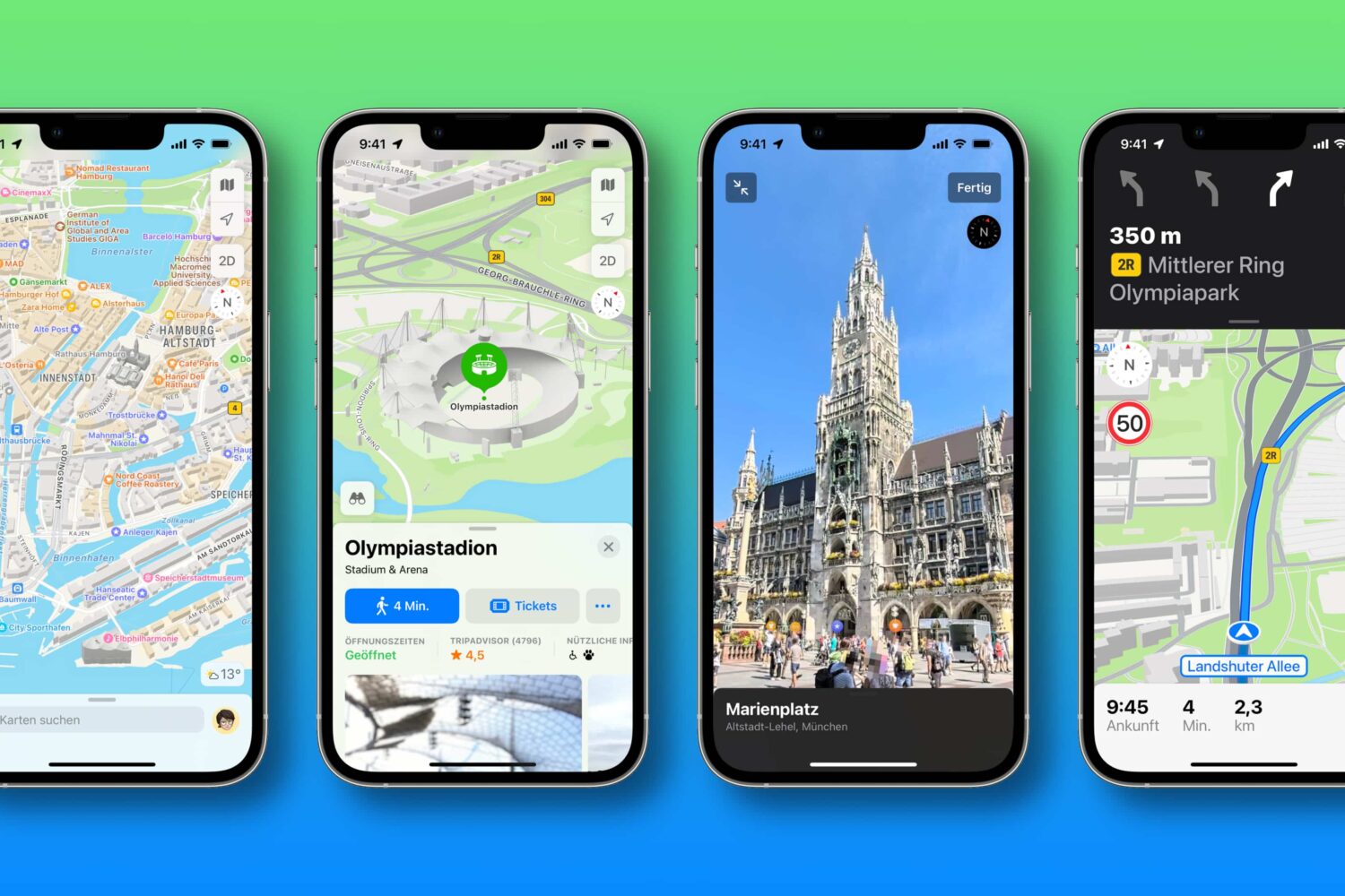
Apple has rolled out the latest Apple Maps improvements to its customers in Germany and Singapore, including 3D landmarks, street-level photography, improved navigation, more detailed road coverage and other perks.
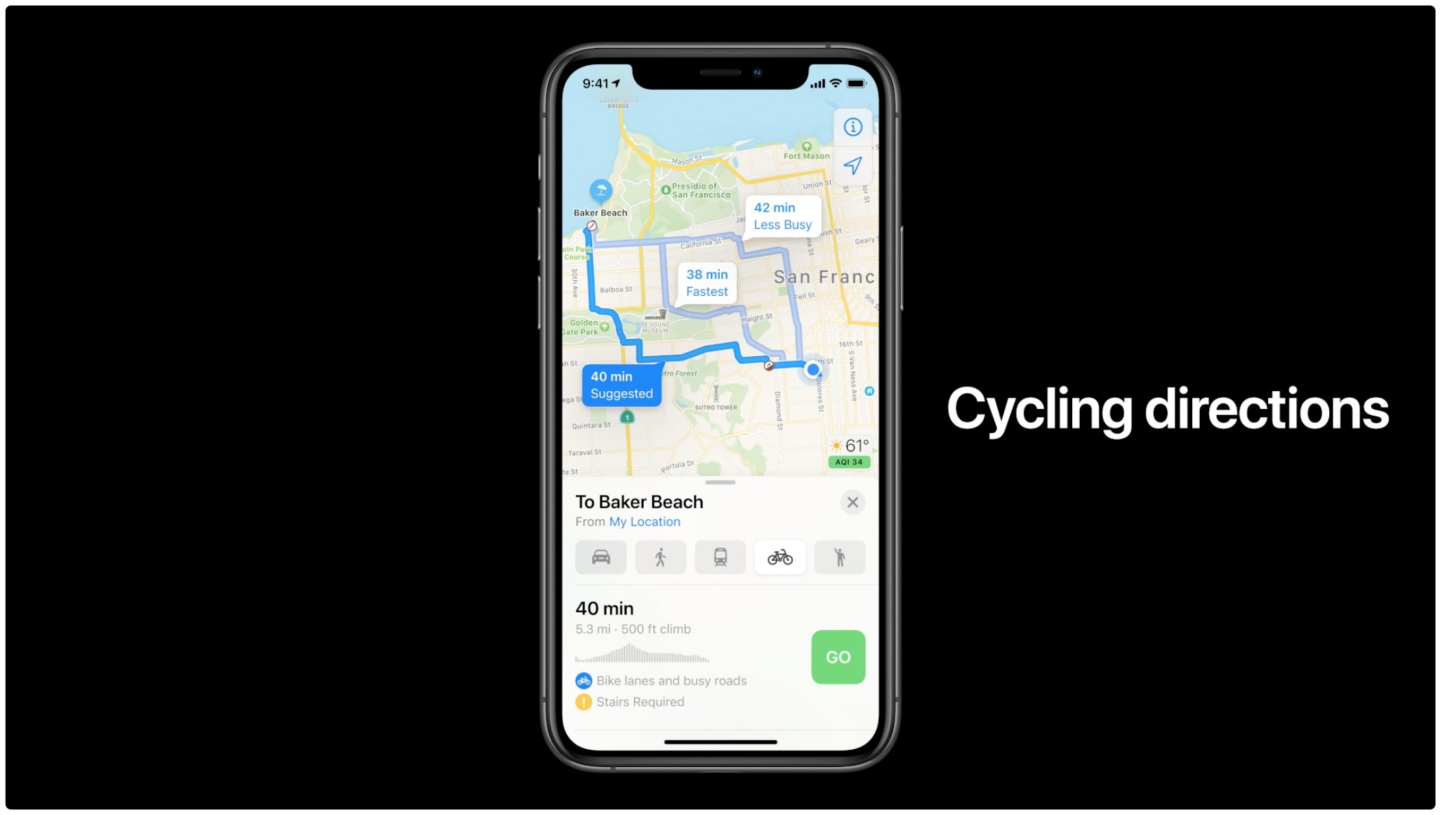
Apple Maps now provides cycling directions in additional Midwestern cities in the US, helping cyclists in those areas find the best routes with bike lanes.
Navigating with Google Maps on your iPhone and Apple Watch will soon get easier thanks to a more detailed map, a dedicated watchOS app and other new features.
Apple Maps now shows 3D landmarks in Philadelphia, allowing iPhone, iPad and Mac users to view custom 3D objects when exploring such locations as One Liberty Place.