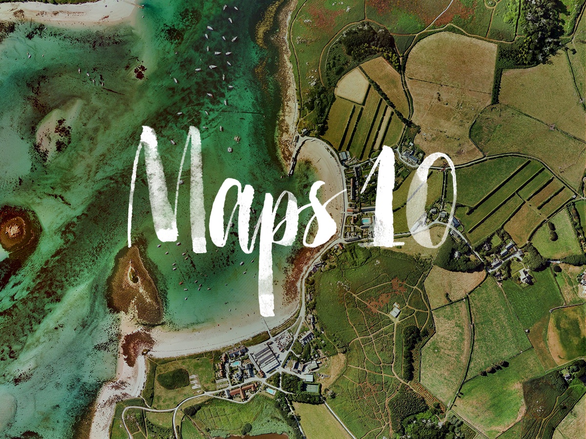
Yesterday marked the tenth anniversary of Google Maps, arguably the best consumer mapping application in the world.
Maps first started as a C++ program designed by two Danish brothers Lars and Jens Eilstrup Rasmussen at the Sydney-based company Where 2 Technologies.
After pitching their idea for a web-based version to Google management, the search giant in its never-ending pursuit of new revenue sources snapped up the young startup in October 2004.
Under Google’s stewardship and the oversight of current Yahoo CEO Marissa Mayer, who in 2005 became Vice President of Search Products and User Experience at Google, the project quickly transformed from a relatively unimpressive desktop program into a full-blown web service.
Since its inception, Google Maps has been praised by critics and haters alike for its accuracy, coverage and the rapid pace of development resulting in new feature additions on a regular basis. It’s been imitated by both Yahoo and Microsoft, and later by Apple, but none of these technology giants has come close to touching Google Maps.
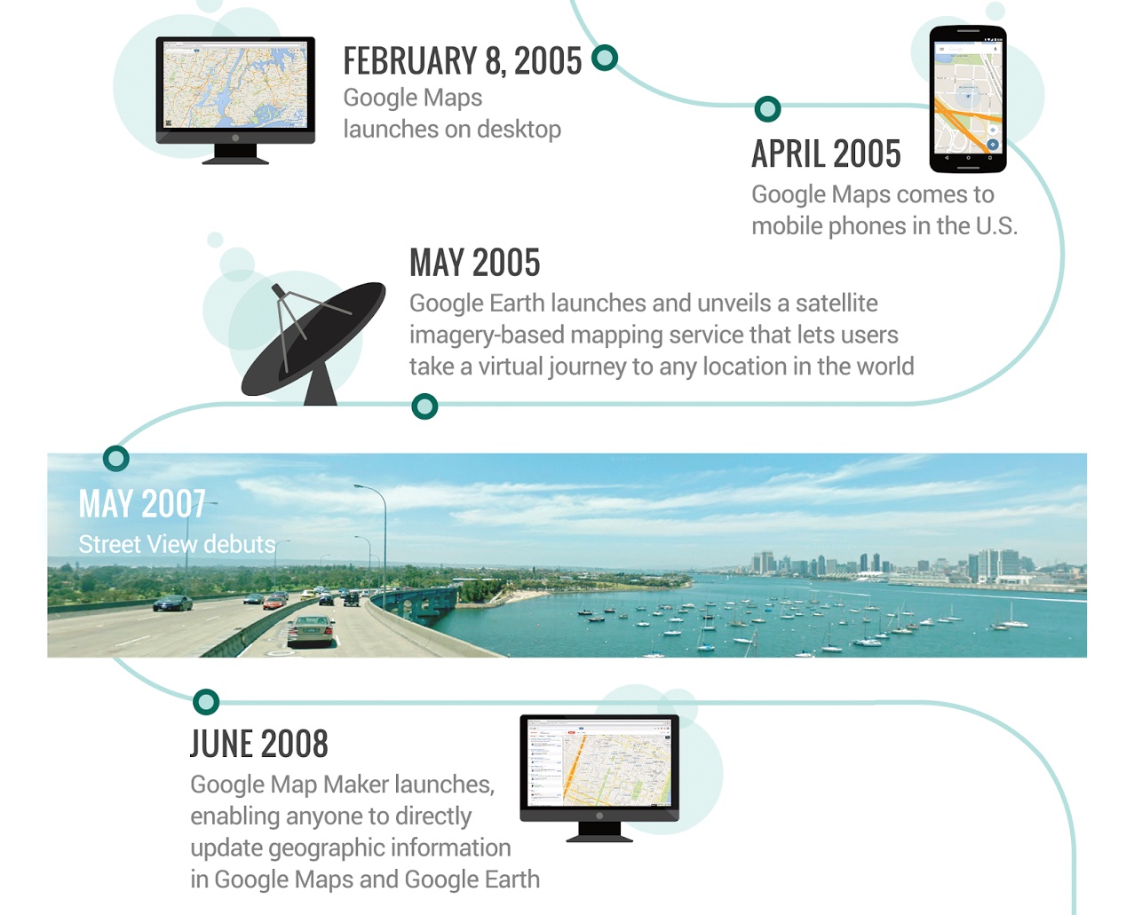
“We think maps can be useful and fun, so we’ve designed Google Maps to simplify how to get from point A to point B,” reads Google’s announcement blog post dated January 8, 2005.
The service from the onset sported vector maps, nearby points of interest, step-by-step directions and more. In April 2005, a brand new (and pretty basic) mobile Maps app launched on select handsets in the United States.
A month later, Google Earth rolled out for Mac and Windows PCs, bringing with it stunning satellite imagery and 3D views that really helped ignite public interest in mapping services. With Google Earth, anyone could “spy” on their neighborhood.
In May 2007, Street View launched, bringing out another jaw-dropping feature to Google Maps on the web: 360-degree street-level photography.
It wasn’t until the iPhone’s debut on June 29, 2007 that Google Maps took off in a big way. As you know, Google Maps was among the headline features of the iPhone. Apple built it in partnership with Google and Steve Jobs went as far as to call it ”the best mapping application on any platform” during his January 2007 iPhone keynote.
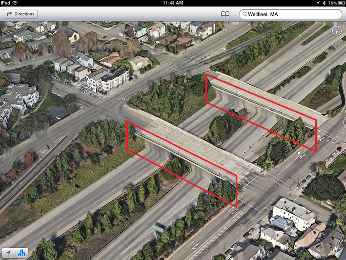
Five and a half years later, Apple killed Google Maps on the iPhone and iPad with the arrival of iOS 6 in September 2012.
But putting out a half-baked and much-maligned Maps service, seen above, quickly backfired. After the widely reported rendering issues and inaccuracies have tarnished the Apple brand, this rare misstep for Apple culminated in a CEO apology and the ousting of iOS boss Scott Forstall.
From there, the Apple Maps team doubled down on making sure the service wasn’t plagued with inaccuracies. Over time, Apple would enrich its Maps with better and more reliable data from third-party sources like TomTom and others.
Yet, nearly eight years since Google launched Street View, Apple still lacks this marquee feature. Only recently was Apple suspected of sending a fleet of mysterious black vans outfitted with cameras to roam streets throughout the country. Watchers believe the purpose of those vehicles is improving 3D Flyover view and maybe adding street-level photography to Apple Maps.
Be that as it may, Google back in June 2008 launched Maps Maker, giving everyone a much-needed tool to report inaccuracies and directly update geographic information in both Google Maps and Google Earth.
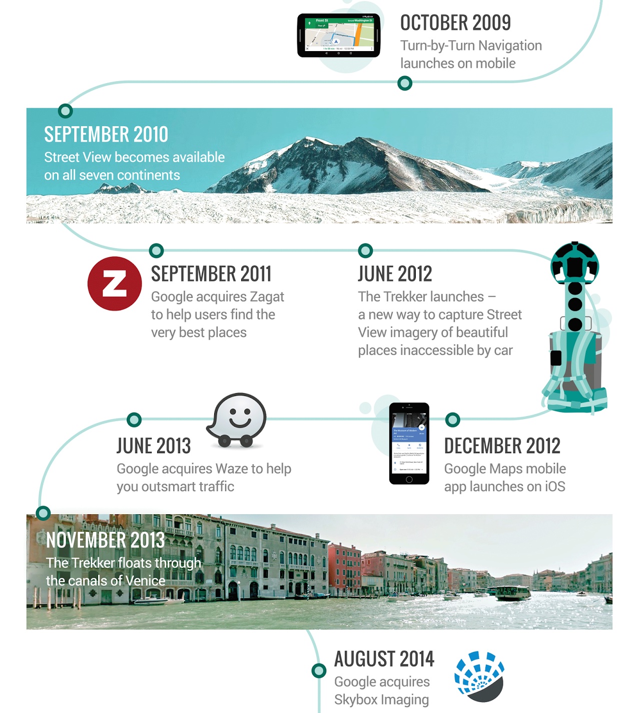
October 2009 brought turn-by-turn directions to Google Maps for Android and September 2010 enabled Street View across all seven continents. In September 2011, Google bought Zagat and integrated its database with Google Maps.
In June 2012, Street View became ever more awesome as Google announced the Trekker, a new imagery-gathering apparatus in the form of a wearable backpack outfitted with cameras. The Trekker can be leased and is used to capture Street View data in areas inaccessible by cars.
The much-awaited native Google Maps application for the finally hit the App Store in December 2012. Nearly a year later, the utilitarian design of Google Trekker came into full view as the Street View team captured the canals of Venice.
Last August, Google bought Skybox Imaging, which owns satellites that circle the orbit of the Earth and take very detailed photographs of the terrain.
And just this past week, the search firm introduced +Local Guides, a feature that gives top reviewers (also known as Local Guides) a special badge next to their review of a place with the latest version of Google Maps for Android.
“As we look ahead to the next 10 years, we hope you’re as excited as we are to navigate uncharted territory in pursuit of the perfect map—together,” reads Google’s celebratory blog post.
Although Apple Maps is vastly improved and in some aspects even one-ups Google’s offering, I don’t think anyone in their right mind would argue that Apple’s beaten Google to the mapping punch because it hasn’t.
Don’t forget that Google has a ten-year headstart in mapping. Mapping is hard and no matter how you look at it, Apple has a long way to go before its Maps service becomes good enough to replace Google Maps on iOS for enough people.
So happy birthday, Google Maps, and here’s to the next ten years.
Do you use Google, Apple or some other provider for maps and navigation?