The newest Apple Maps features, such as improved navigation, Look Around, Share ETA, richer maps and other perks, are now available to customers in Australia.
HIGHLIGHTS
- Features include Share ETA, detailed road coverage and more
- Three-dimensional landmarks like the Sydney Opera House
- AR walking directions coming soon to Sydney and Melbourne
Apple Maps in Australia gains new features
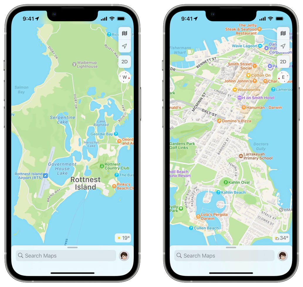
Apple Maps had been surveying Australia from February 2021 through June 2021. The gathered data served as the basis to implement improvements like comprehensive views of roads, buildings, parks, airports and shopping centers. Now those enhancements are available to customers in Australia on iPhone, iPad, Mac, Apple Watch and CarPlay beginning today, according to a post on the Apple Newsroom website.
Here’s a quick list of Apple Maps features that are now available Down Under.
- More detailed road coverage: Richer road and object details
- Improved navigation: Faster, more accurate navigation
- Look Around: Street-level imagery akin to Google Maps’ Street View
- Flyover: Experience a supported location in 3D, from above
- Share ETA: Share your ETA with contacts
- Richer metadata: More accurate information for places
- Guides: Curated list of locations to eat, shop and more
These are not the only Maps improvements available in Australia.
Speed cameras, city guides and more
Other notable updates include Siri Natural Language Guidance, a feature offering more natural-sounding directions to follow. With lane guidance, drivers in Australia can use Apple Maps to stay in the correct lane before needing to turn or enter an elevated road.
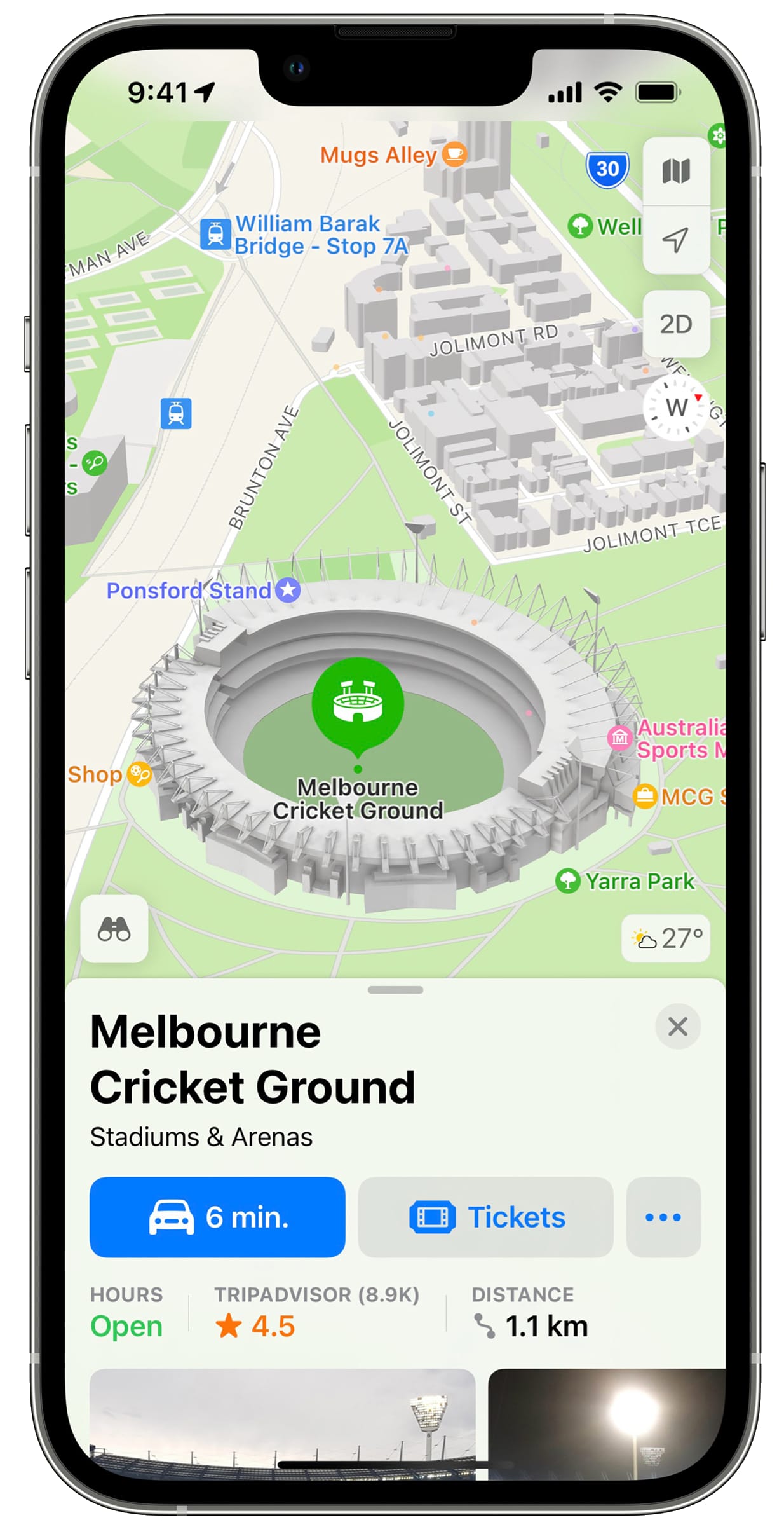
Australians will also appreciate speed and red-light camera warnings, incident reporting, as well as three-dimensional landmarks of locations such as the Sydney Opera House. And with Guides, users can explore curated lists of places of interest such as restaurants and shopping malls. Read: How to use curated city guides on Apple Maps
Culture Trip, Louis Vuitton City Guides, Prior, Thrillist Australia and Time Out have created Guides for Sydney and Melbourne, with more to come from Broadsheet, Concrete Playground and Qantas Travel Insider.
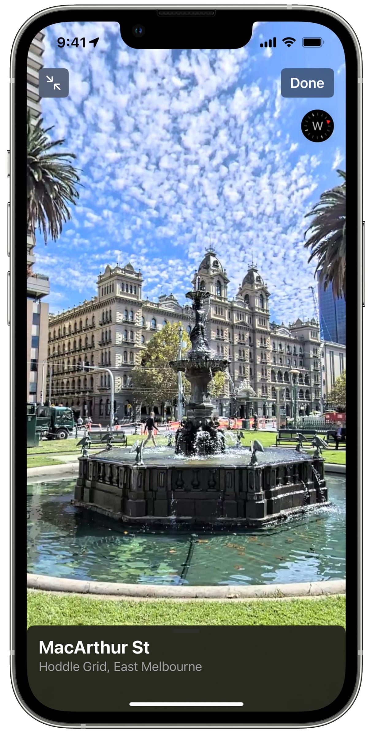
Immersive AR walking directions
Aside from the aforementioned updates, customers in Sydney and Melbourne will soon be able to receive step-by-step walking guidance in augmented reality.
These AR walking directions can be very immersive. You simply raise your iPhone to scan buildings in the area and Maps does its magic, delivering detailed directions that can be viewed in the context of the real world.
New features for transit riders in Australia
Any transit riders in Australia with iOS 15 installed on their iPhone can now find nearby stations more easily and pin favorite lines.
Maps automatically follows along with a selected transit route, notifying users when it’s nearly time to disembark, and riders can even keep track on Apple Watch. Real-time transit information gives detailed transit schedules, live departure times, arrival times, the current location of a bus or train en route and system connections to help plan a journey.
As a bonus, Maps even shows important real-time information like outages.