Hurricane tracking apps are must-have tools if you live or plan to visit areas where the annual Atlantic hurricane season takes place from June 1 through Nov. 30. These useful apps can help you stay safe even when bad weather hits.
Criteria
When we were looking for hurricane-related apps, we wanted to make sure the titles were recently updated, have already been tested in previous storms, and when it’s a paid app, offers extra value. These apps fit that criteria, and more.
National Hurricane Center Data

For both iPhone and iPad, the National Hurricane Center Data app displays 8-hour satellite imagery animations, so you always know when a storm’s about to hit. In total, the app includes 10 useful filters, letting you view storm information from different perspectives. This includes Visible, Shortwave AR, Water Vapor, RGB, AVN, Dvorak, JSL, Funktop, Rainbow, and RBTOP.
Notable features:
- 8-hour NOAA/NHC Satellite Imagery.
- 5-day Hurricane Forecast.
- 5-day Tropical Storm Outlook (Pacific).
- 5-day Tropical Storm Outlook (Atlantic).
- NWS Tropical Weather Discussion.
Optimized for iPhone X, the universal National Hurricane Center Data app cover storms in both the Atlantic and Pacific Oceans.
- Availability: iPhone and iPad
- Cost: $1.99
Hurricane Tracker
One of the oldest weather apps on the App Store, Hurricane Tracker offers over 65 maps and images for both the Atlantic and Eastern Pacific Basin. It provides real-time National Hurricane Center Updates, tropical audio updates, and storm video.
Notable features:
- Includes exclusive “Alert Level” and “Long Range Potential” maps.
- One of the oldest hurricane tracking apps on the App Store.
- In-depth written discussions and analysis.
- Real-time National Hurricane Center Updates.
Hurricane Tracker provides lots of useful information at a price point that’s worth it. It covers the Gulf of Mexico, Caribbean, Atlantic Ocean, and Eastern Pacific.
- Availability: iPhone only
- Cost: $3.99, plus in-app purchases that allow you to contribute for future app development.
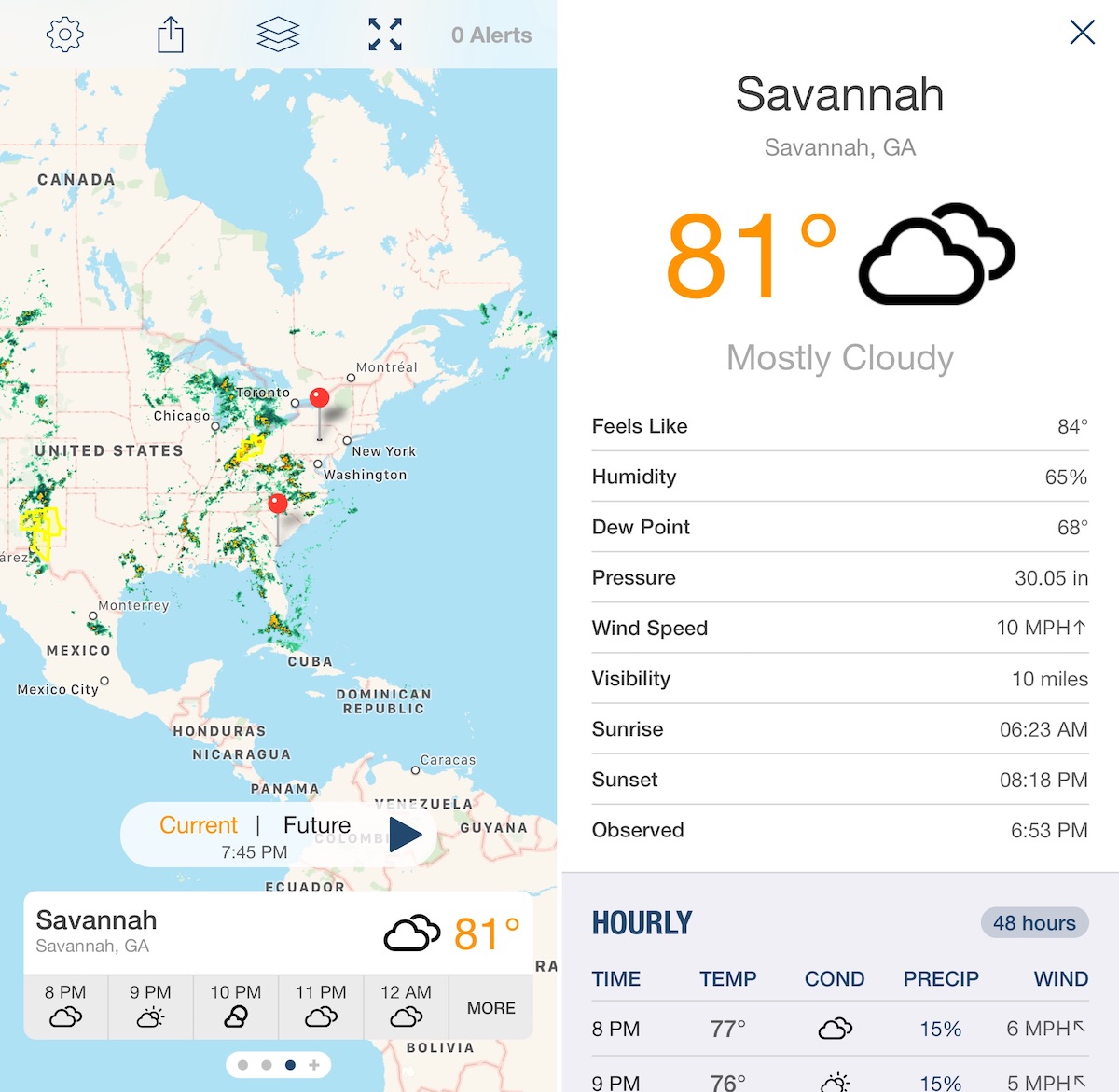
Storm Radar: NOAA Weather Map
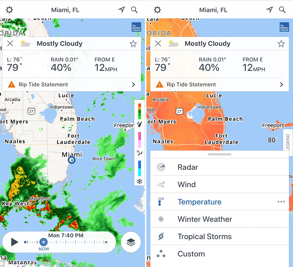
With data from The Weather Channel, Storm Radar offers an HD interactive radar map so you can always see what’s coming your way. View live weather patterns around the world or keep ahead of the storm with six-hour predictive radar.
Notable features:
- View wind speed, storm tracks, more.
- Customize your radar map with detailed data overlays such as seismic activity and temperature.
- Get notified of incoming rain with real-time precipitation updates for your area.
- Be aware of hazardous lightning strikes: get live lightning alerts for your GPS location.
Storm Radar offers detailed, color-coded view of weather patterns in your area, including how much wind and rain to expect. Know when and where the storm will hit with future radar across land and sea. Set live local storm alerts and severe weather warnings with ease.
- Availability: iPhone and iPad
- Cost: Free
Storm Shield
This freemium app from the E.W. Scripps Company provides severe weather alerts for your location or anywhere in the U.S. Storm-based alerts help reduce false alarms by alerting you whenever there’s a severe weather pattern forming at your exact location with a county, not just for the county as a whole.
Notable features:
- With Apple Watch, get a tap on your wrist when alerts are issued for your locations.
- High Definition radar map is your Home screen so you can immediately see what’s going on at your locations.
- View current conditions, hourly and daily forecasts.
Storm Shield provides lots of features for free, or you can buy a $1.49-per-month special Weather Bundle as an in-app purchase.
- Availability: iPhone, iPad, and Apple Watch
- Price: Free plus in-app purchases, including the ability to add future radar, storm tracks, lightning, and temperature forecast map.
Hurricane: American Red Cross
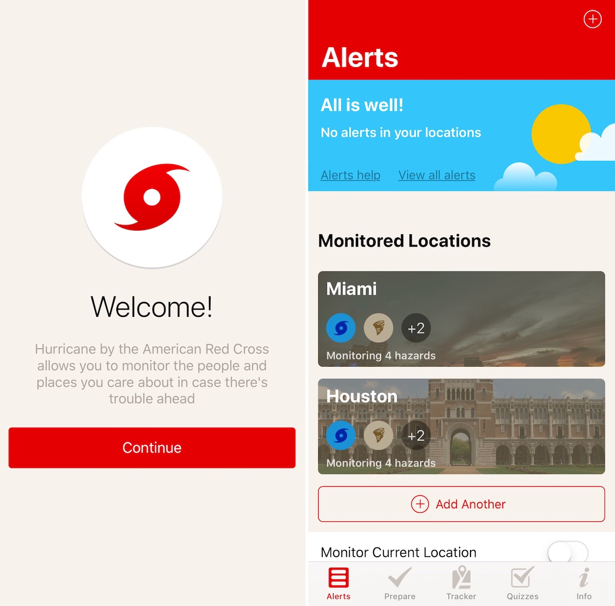
Available in English and Spanish, the Hurricane: American Red Cross app provides step-by-step instructions on what do before and after a storm. Use the app to track the path of the hurricane and find open Red Cross shelters in your area.
Notable features:
- Customizable alerting and push notification options.
- Easy to view alert feed with the ability to remove alerts.
- Let friends know you are okay with the customizable “I’m Safe” alert for Facebook, Twitter, email, and text.
Most hurricane-related apps stop offering information once a storm is gone. The official Hurricane: American Red Cross app is different, providing information before, during, and after a storm.
- Availability: iPhone and iPad
- Cost: Free
Weather Underground: Forecast
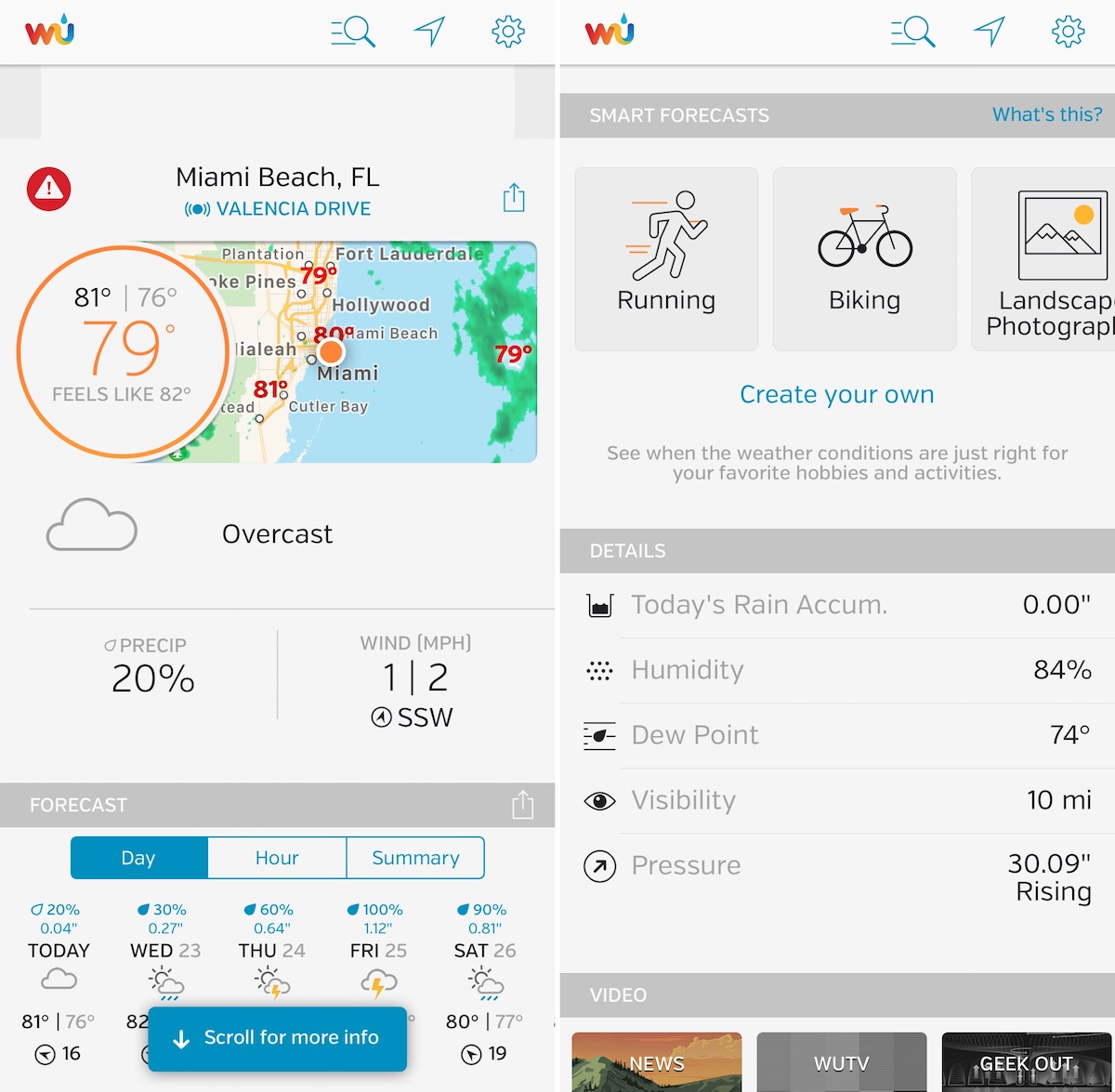
The Weather Underground app offers current conditions from local weather stations around the United States. Use the app to stay updated with current weather data, including temperature, “feels like,” wind speed and direction, today’s rain accumulation, humidity, dew point, visibility, and pressure.
Notable features:
- Powered by a network of 270,000+ personal weather stations.
- Monitor air quality, UV risk, and local flu outbreaks.
- Track global storms.
- Scroll through time with the interactive play-bar for radar and satellite.
Weather Underground is one of the most respected weather providers around the world and why this app remains one of the most popular titles on the App Store.
- Availability: iPhone, iPad, and Apple Watch
- Cost: Free
Hurricane tracking apps
There are countless hurricane-related weather apps on the App Store. The ones presented here are all useful for different reasons, with prices ranging from free to $3.99. If you find yourself in the path of a storm, each of these apps will make a difference and give you peace of mind.
What’s your favorite hurricane tracking app? Let us know below.