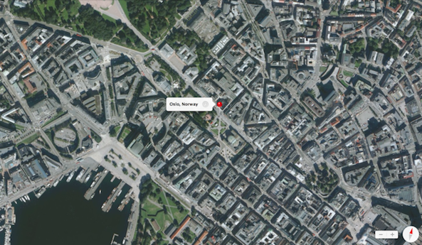
It appears that the Norwegian government is blocking Apple from capturing 3D Flyover footage of Oslo, its capital. The news comes from a report out of Norway-based newspaper Aftenposten.
A Norway government official has confirmed this to be the case, saying the country’s National Security Authority is intentionally blocking Apple from grabbing the aerial data it needs for its Maps app because it doesn’t want the company accidentally mapping out confidential buildings within Oslo…
From Aftenposten’s report (via 9to5Mac):
“Stockholm and Copenhagen are already in the system, but Oslo is missing. The reason is that the National Security Authority (NSM) has said no to Apple’s aerial missions over the city.
We do not want it to be shooting with such a high degree of precision that can be used to identify areas that require special shielding. Photo shoot with this level of detail can provide knowledge about the safety measures that are not desirable that becomes available, said acting director Øyvind Mandt in NSM to Aftenposten.”
As it turns out, Norway’s military has some areas in and around Oslo that are subject to restrictions—there are a few buildings and structures there that were just classified under the Security Act. Mandt says that officials want more time to secure the city before they allow Apple to start shooting.
“There is a problem that we do not have national control over the material collected. There are Norwegian companies that are licensed to do so, and then the Photo above sheltered areas have a strong reduced resolution, so you can not see the details, says Mandt in NSM.”
Apple has contacted the US Embassy on the matter, which in turn contacted Oslo Mayor Fabian Stang. Stang says that he is a fan of the Maps application, and believes it is very relevant for tourists. So he has reportedly contacted Norway’s Minister of Defense, asking him to give the company a pass.
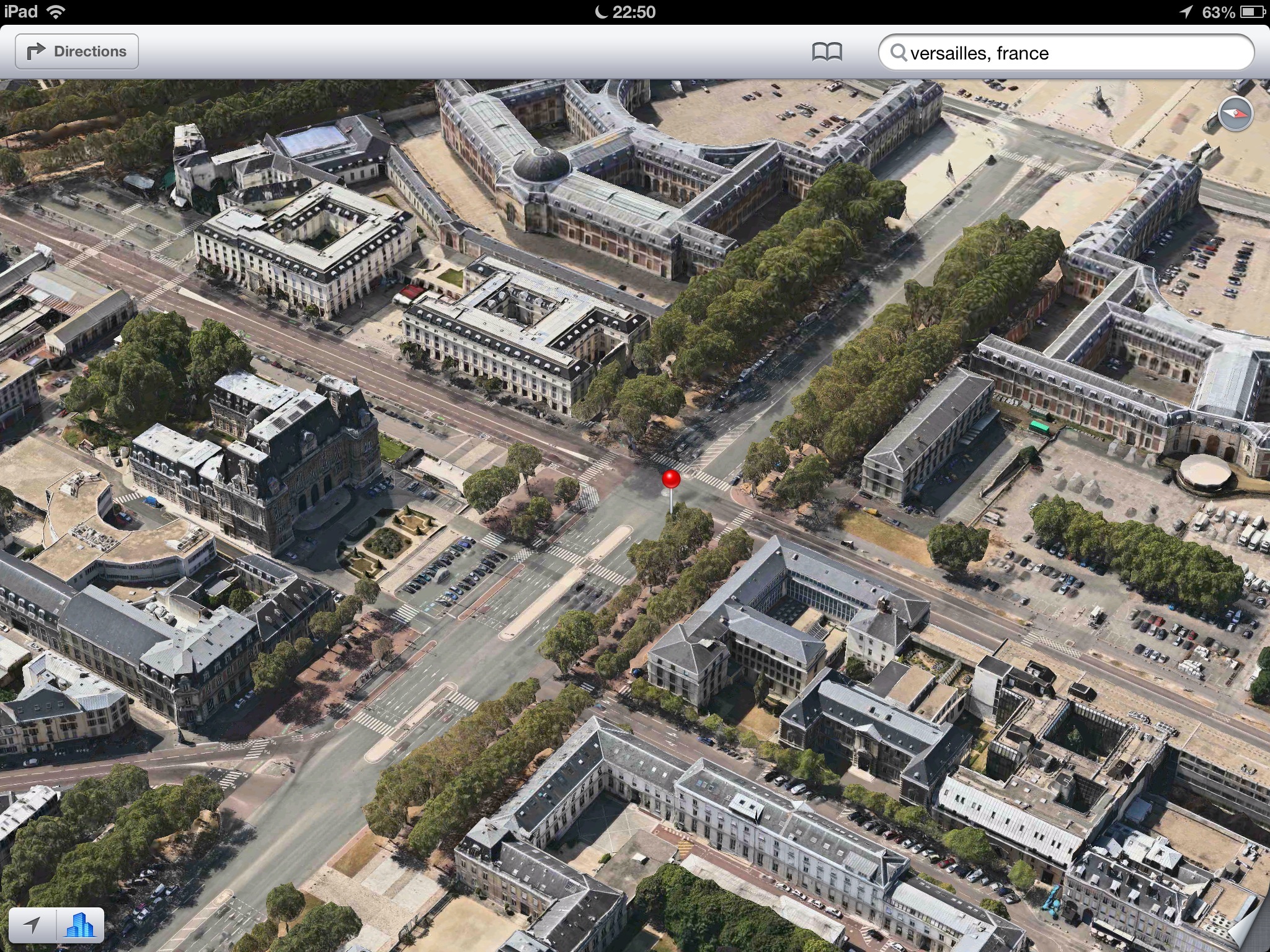 Flyover view of Versailles in France
Apple actually flies planes equipped with advanced camera systems around buildings to capture data for its Flyover feature. The company has pitched the 3D view as one of its Maps app’s top features, since it replaced Google Maps last fall. Currently, the 3D Flyover view is available for most major cities.