With Apple replacing Google Maps with its own in-house solution last fall, it essentially left the folks who use public transit services in the dark. Among its many flaws, Apple’s Maps app doesn’t feature any kind of transit data or directions.
So those who required this information were forced to seek out third party solutions. And today one of the more popular ones, The Transit App, received a major update. It now features real-time vehicle locations and, oh yeah, it’s now free!
Here’s the full 2.0 change log:
** Transit is now 100% free! **
Transit 2.0 also adds:
– Real-time vehicle locations where available.
– New Transit Modes settings let you disable particular modes within a transit agency.
– Autocomplete suggestions now include recent locations.
– New sorting order in Nearby mode taking into account departure time, mode (subway vs bus), distance and favorites.
– Improved schedule popover (long tap on right side of nearby routes cell).
– Offset your location from any stop on an itinerary path.
– Tons of bug fixes and performance improvements.
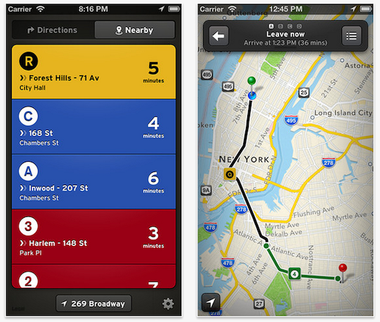
The Transit App has long been highly regarded for its beautiful design and the wide range of information it offers. Where as some apps only offer public transit data from a single city, it provides that information for 37 different US cities.
And it’s even better now that it’s been discounted. While the app has always been free, you used to have to pay a fee of $0.99 a month, $2.99 for 6 months, or $4.99 a year for the service. Not anymore. You can now use everything free of charge.
If you’re interested in checking it out, you can find The Transit App 2.0 in the App Store for free.