It has been a long time coming, especially for iOS users in Canada who have been waiting for it. But, finally, the redesigned and rebuilt Apple Maps experience is now available.
Apple officially announced the expansion today. With the new experience, folks who use Apple Maps will be able to get a lot more useful information. That includes data for pedestrians, more detailed land cover, especially in cities, and more road coverage. The all-new Guides experience is now available as well, and so is the Look Around feature — Apple’s answer to Google’s Street View.
With Apple Maps, we have created the best and most private maps app on the planet and we are excited to bring this experience to our users in Canada,” said Eddy Cue, Apple’s senior vice president of Internet Software and Services. “We have rebuilt Apple Maps from the ground up to provide better navigation, richer detail, more accurate information for places, and incredible features like Look Around, curated Guides from trusted sources, and much more. Now it is easier than ever for users in Canada to explore and navigate the world.
Resource: How to use City Guides in Apple Maps
The all-new Apple Maps experience also includes a lot more. Users can now find routing for electric vehicles, letting owners know where their next top-up spot is. Guidance for navigation now supports Siri’s natural language, and real-time transit information is now available as well.
Here are the major bullet points from today’s announcement:
- Electric vehicle routing, which will be available on compatible vehicles, adds charging stops along a planned route based on current vehicle charge and charger types.
- Siri Natural Language Guidance provides more natural-sounding directions that are even easier to follow, such as, “At the next traffic light, turn left.”
- Real-time transit information gives detailed transit schedules, live departure times, arrival times, the current location of a bus or train en route, system connections, and information like outages to help plan a journey. Real-time transit is available in cities in the provinces of Alberta, British Columbia, Ontario, Quebec, and more across Canada.
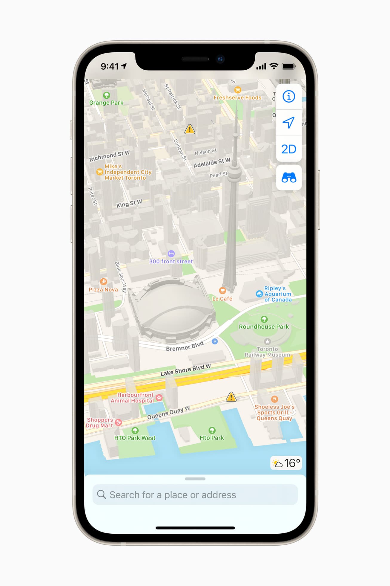
- Flyover offers a way to see select major metro areas, such as Calgary, Montreal, Toronto, Vancouver, and more, with photo-realistic, immersive 3D views. Users can move their device through space to experience a city from above, or explore in high resolution as they zoom, pan, tilt, and rotate around the city and its landmarks.
- Indoor Maps for airports and malls in Calgary, Edmonton, Montreal, Quebec City, Toronto, and more, makes it possible for users to simply open the Maps app and see what level they are on, restroom locations, and even which stores and restaurants are open.
- Share ETA sends an estimated time of arrival to family, friends, or coworkers with a simple tap. The receiver can follow along on the journey, and Maps will even update them with a revised estimate for when the traveler is arriving if a significant delay occurs.
- Speed cameras will let users know when they are approaching speed and red light cameras along a route, with the added ability to see where they are located on the map.
- Favourites provides one-tap navigation to frequent places. Whether it’s home, work, the gym, or school, users can simply tap and go once the location is in Favourites on the launch screen.
- Flight status uses on-device Siri intelligence to scan for information stored in Mail, Calendar, or Wallet, and proactively serves flight information for terminals, gate locations, departure times, as well as flight changes or cancellations for upcoming travel.
Resource: How to use Look Around in Maps for a street level view
The redesigned and improved Apple Maps experience is now available across Canada.