More than four months after Apple Maps users in the United States gained the ability to locate ChargePoint electric vehicle stations around them, Apple is bringing a similar feature to its customers in the United Kingdom. As a cool bonus, European users can now identify bike rental hubs on a map, too.
According to Bloomberg earlier this week, Apple is using data from German company Cirrantic’s Moovility service, which maintains a detailed list of charging stations for electric vehicles made by Tesla and Nissan, among others.
“We think that consistent, live information of the growing charger infrastructure increases the confidence of EV drivers and, especially with Apple Maps, attracts new user groups to sustainable mobility offerings like EV cars,” said Arne Meusel, CEO and co-founder of Cirrantic.
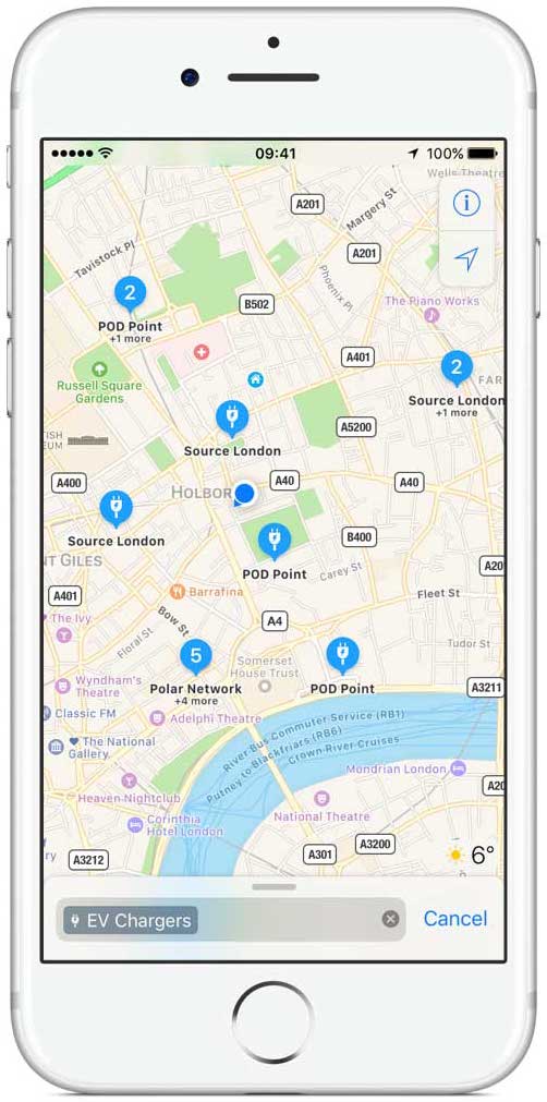
In the U.K. alone, the company supports major charger operators like Podpoint, CYC, Ecotricity, NPower and NewMotion. All in all, Maps fans in the U.K. can now find more than 3,000 electric vehicle charging stations on the service.
According to data compiled by Zap-Map, there are just under 4,400 locations in the U.K. for recharging an electric vehicle. Unlike with Google Maps, Apple’s mapping service explicitly labels re-juicing points for electric cars with easily identifiable icons.
TIP: How (and why) to display hourly weather forecast for your destination on Apple Maps
Aside from providing information about EV charging stations in the U.K., Maps now includes public bicycle rental and drop-off points in London, Paris and New York. Google has listed such stations in multiple countries for some time.
Apple Maps is available on iPhone, iPad, iPod touch, Mac and Apple Watch.
Bloomberg previously reported that Apple was assembling a team to use drones to create and update map information faster than it can currently do with camera-equipped road vehicles.
The Cupertino company could soon add additional capabilities to Maps, including a feature that would leverage data from iPhone’s pressure sensors, GPS, Wi-Fi and Bluetooth to let people navigate indoor areas such as airports, museums and other high-traffic buildings.
Any new Maps features that could be in the works should be previewed publicly at the company’s annual developers conference scheduled to kick off with a keynote on June 5.
Source: Bloomberg