Navigation

Dark Maps forces dark mode in Apple Maps at all times

The Apple Maps app is designed to display maps in light or dark mode based on one of two different circumstances; 1) the user’s system light or dark mode setting, and 2) the time of day it is.

Wouldn’t it be nice, however, if the app allowed you to choose between light or dark mode all the time without having to switch your system light or dark mode setting and without having to wait for a specific time of the day? If you answered yes, then you’re in for a treat.

Google Maps rolls out an awesome new AR view for navigation inside malls and airports

An image showing three generic handsets running Google Maps with Live View augmented reality mode for AR navigation inside malls and airports

Google is bringing an awesome new mode to its mapping app for iOS and Android designed for augmented reality (AR) navigation inside shopping malls and airports.

STORY HIGHLIGHTS:

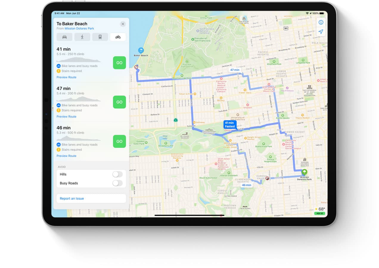
Indoor AR navigation in Google Maps. Works inside shopping malls and airports. New eco-friendly route options due later in 2021.

AR indoor navigation with Google Maps

This has been confirmed in a blog post on the Google website, which outlines a couple of new Google Maps features slated to hit iOS, iPadOS and Android devices later this year.

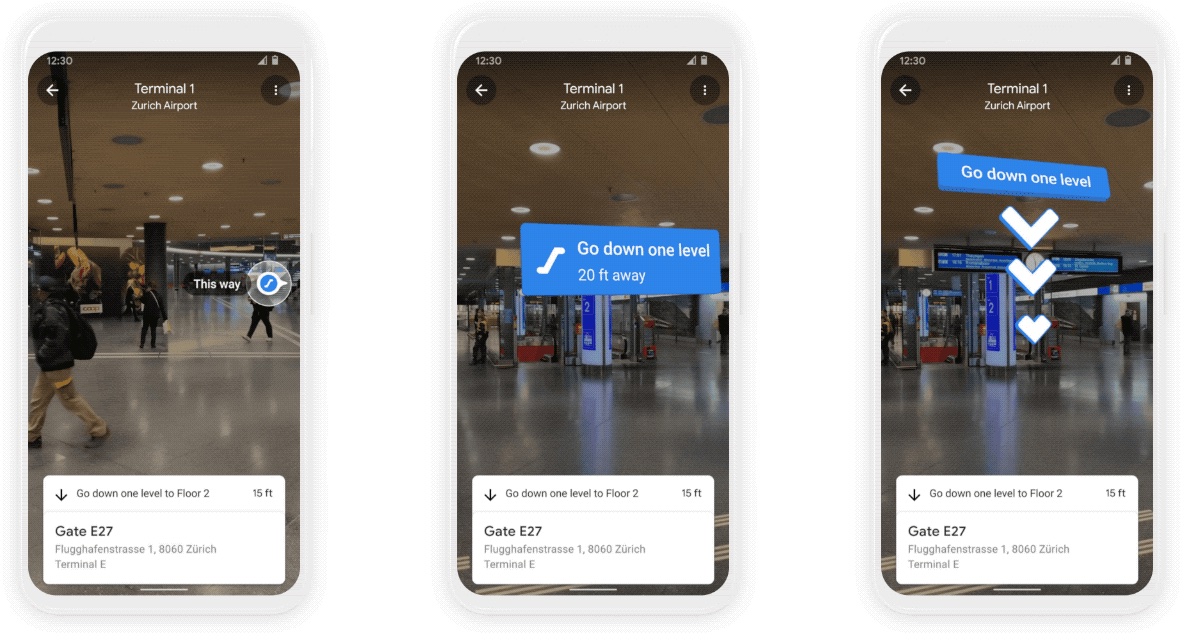
Called Live Mode, the new feature gives you accurate turn-by-turn directions inside shopping malls and airports by taking advantage of artificial intelligence to “scan tens of billions of Street View images to understand your orientation.”

Thanks to new advancements that help us understand the precise altitude and placement of objects inside a building, we’re now able to bring Live View to some of the trickiest-to-navigate places indoors: airports, transit stations and malls.

The feature debuted in Google Maps for iOS and Android for a handful of shopping malls in Chicago, Long Island, Los Angles, Newark, San Fransico, San Jose and Seattle. In the coming months, it'll roll out to select airports, malls, and transit stations in Tokyo and Zurich.

Additional cities and locations are coming in the future.
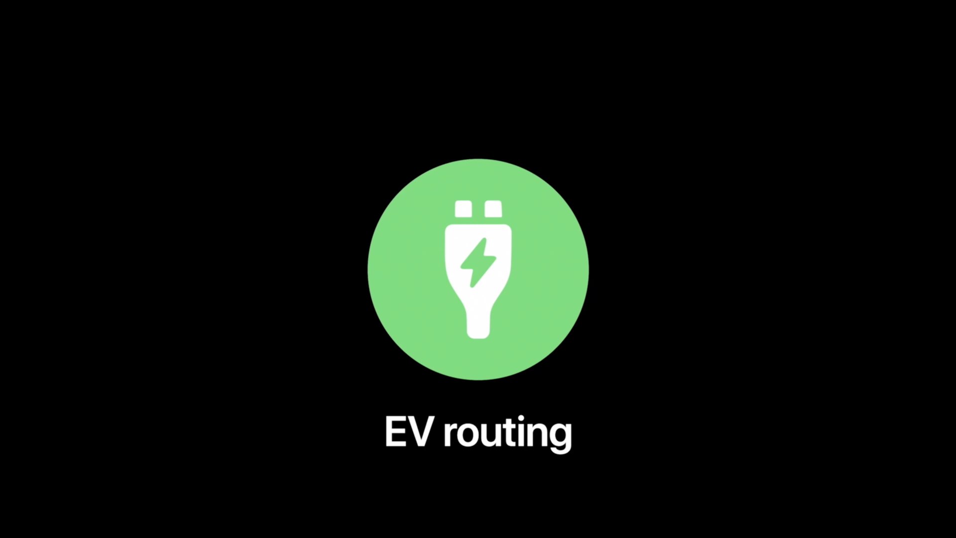
Eco-friendly routes

Aside from AR indoor navigation, Google Maps will also gain eco-friendly routes later this year.

With insights from the U.S. Department of Energy’s National Renewable Energy Lab, we’re building a new routing model that optimizes for lower fuel consumption based on factors like road incline and traffic congestion.

When that feature is launched publicly, Google Maps will default to the route with the lowest carbon footprint when it has approximately the same ETA as the fastest route, Google says.

→ What are lists on Google Maps and how do I use them?

“In cases where the eco-friendly route could significantly increase your ETA, we’ll let you compare the relative CO2 impact between routes so you can choose,“ reads the post. Google will let you change your defaults to have the app, for example, always show the fastest route.

Eco-friendly routes will be available on both iOS and Android later this year. Initially, this feature will cover the US, but Google's promised a global expansion arriving at some point.

Air quality and other tidbits

Google even outlined some of the features that will be coming to its mapping service later this year, including weather and air quality information, with the relevant data being pulled from such partners as The Weather Company, AirNow.gov and the Central Pollution Board.

With the new weather layer, you can quickly see current and forecasted temperature and weather conditions in an area—so you’ll never get caught in the rain without an umbrella. And the new air quality layer shows you how healthy (or unhealthy) the air is—information that’s especially helpful if you have allergies or are in a smoggy or fire-prone area.

→ How to use filters to search for Google Maps locations

Weather information and the air quality index will hit Google Maps on iOS and Android “in the coming months.” The weather layer will be available globally and the air quality layer will launch in Australia, India and the US, with more countries to come—you guessed right—at a later time.

Both weather and air quality information have been available on Apple Maps for some time.

And lastly, stores’ business profiles available on Google Maps and through Google Search will now display useful information such as delivery providers, pickup and delivery windows, fees, as well as order minimums. This is currently available via Google Search on mobile, starting with Instacart and Albertsons Cos. stores in the US.

The feature will extend to Maps and expand to other partners in the future.

How to navigate the desktop, Dock, and Mission Control using VoiceOver

Use VoiceOver on a MacBook Pro Desktop

The built-in VoiceOver feature on Mac gives you an easier way to do things if you need some extra help. With keyboard commands and spoken feedback, you can take care of tasks that may normally be visually difficult.

With this, you’ll need to know how to navigate the areas of your Mac like the desktop, Dock, and Mission Control. And that’s where this next VoiceOver on Mac how-to will take you. We’ll show you the commands you need for moving around these major areas of your Mac.

SilentMaps13 makes Apple Maps navigation less intrusive to music playback

It’s fairly common for drivers to listen to music as they cruise around, and with CarPlay and Bluetooth accessories becoming more popular in modern cars, it becomes more and more likely that drivers will stream their music from their smartphone as opposed to the radio. Another thing drivers often use is their handset’s built-in navigation feature, and unfortunately, directions from the Maps app have a tendency to announce directions at all the worst times…

Enter SilentMaps13, a newly released jailbreak tweak by iOS developer Greg0109 that helps prevent the Maps app from announcing directions right as the beat of your favorite song drops. The tweak offers user-configurable alternatives to having Siri’s voice interrupt your track, and it’s sure to offer an augmented user experience when used in a navigation-esque setting while listening to music in the car.

How to configure and use electric vehicle routing in Apple Maps on the iPhone and iPad

The Apple Maps electric vehicle routing feature helps environmentally-conscious drivers plan trips with supported electric cars by automatically adding charging stops along their routes. With it, an iOS device offers to route you to the nearest charging station when your charge gets too low. Follow along with us to learn how to set up and use electric vehicle routing in Maps.

How to share your ETA in Apple Maps with Siri

As you follow turn-by-turn driving directions in Apple Maps on your iPhone, iPad or iPod touch, you have the option to let others know your estimated time of arrival (ETA). That being said, however, responsible drivers shouldn't really be taking their eyes off the wheel to tap through the menus. Thankfully, in iOS 14 and iPadOS 14, you can ask Siri to share your ETA, hands-free. In this tutorial, you're going to learn how to share your ETA in Apple Maps with Siri.

How to use the redesigned sidebar in Files app

Redesigned Files on iPadOS 14

If you’re a fan of Files and use it on your iPad, you’re going to love the update with iPadOS 14. The revamped sidebar gives you a centralized location for navigating all of your items. And, removal of the toolbars at the top and bottom give you more room for your items.

Here, we’ll show you what’s been added, removed, and improved with the redesigned Files app on iPad.

How to use the sidebar in Photos on iPad

Portrait View Sidebar Photos iPad

With the release of iPadOS 14, Apple has updated the navigation in the Photos app. So if you weren’t a fan of it before, maybe you’ll like this different way to maneuver your photos and albums.

You can display a convenient sidebar in Photos to navigate things like your Library, Favorites, Recents, Media Types, and Shared Albums. Here’s how to use the sidebar in Photos on iPad.