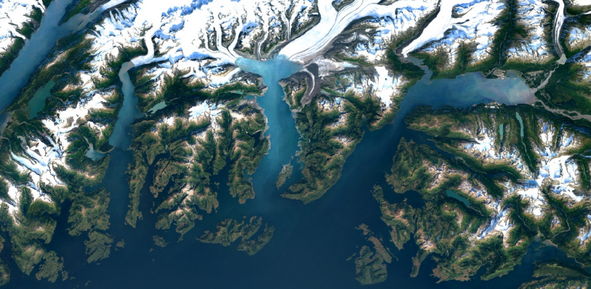
Google is upgrading the quality of aerial imagery for the satellite view that’s available in Google Maps and Google Earth services. According to a blog post yesterday, both mapping services now offer crisp high-definition satellite imagery of Earth without clouds captured by Landsat 8, an Earth observation satellite launched on February 11, 2013 in a collaboration between NASA and the United States Geological Survey (USGS).
Crisper, cloud-free mapping
Before today, Google Maps and Google Earth used mosaic imagery from Landsat 7 only, which at the time was the best imagery of its kind. “Unfortunately, Landsat 7 images captured after 2003 were affected by a hardware failure, resulting in large diagonal gaps of missing data,” said Google.
Landsat 8 captures twice as many images as Landsat 7 does every day, with greater detail and truer colors. “This new rendition of Earth uses the most recent data available—mostly from Landsat 8—making it our freshest global mosaic to date,” said Google.
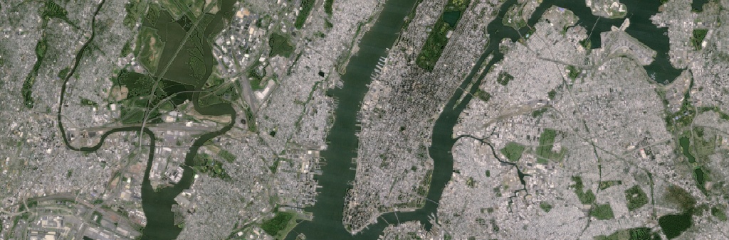
Here’s the view of New York City in Google Maps before the change.
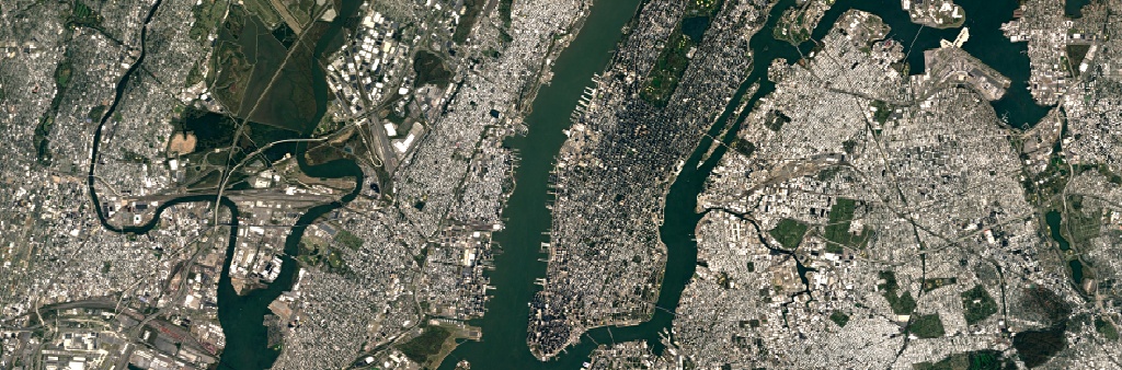
Pictured below: the new birds-eye view of New York City after the change. Note how details like skyscrapers, building shadows and baseball and softball fields in Central Park shine through due to an increased resolution of cloud-free satellite imagery.
Massive amounts of satellite data
To see the new imagery, launch Google Earth on desktop/mobile or turn on the satellite layer in Google Maps. Note that some people may be still seeing old images in the app because the new massive imagery database takes time to propagate.
The Google Earth engine now mines data from nearly a petabyte of Landsat imagery—which works out to more than 700 trillion individual pixels—to choose the best cloud-free pixels.
Fun stat: 700 trillion pixels is 7,000 times more pixels than the estimated number of stars in the Milky Way Galaxy. Or to put it another way, it’s 70 times more pixels than the estimated number of galaxies in the Universe.
Cutting-edge Landsat 8 satellite
Landsat 8 contains a next-generation Operational Land Imager (OLI) instrument which uses a pushbroom sensor instead of whiskbroom sensors that were utilized on earlier Landsat satellites. The new sensor aligns the imaging detector arrays along Landsat 8’s focal plane allowing it to view across the 115-mile (185 kilometers) cross-track field of view.
Taking advantage of more than 7,000 detectors per spectral band, the pushbroom design results in increased sensitivity, fewer moving parts and improved land surface information.
Google Maps is a free download for the iPhone and iPad in the App Store.
Google Earth for iOS is available at no charge via the App Store. Google Earth for Mac is a direct download from Google.
Source: Google