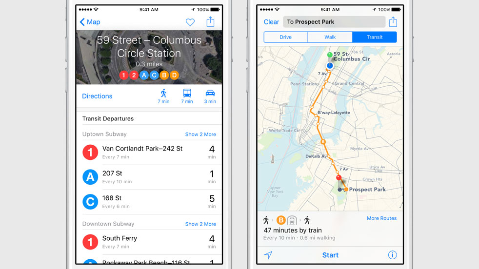
It’s transit time! Apple just announced at its Worldwide Developers Conference in San Francisco’s Moscone West that its mapping and navigation service will soon provide transit lines, bus stations, ferry lines and more.
Available across Mac, iPhone, iPad and iPod devices, the improved Apple Maps app will sport departure times, multi-modal routing with step-by-step directions, estimated times for walking directions and much more.
You’ll be able to find locations by type with just a tap, with a new icon in Maps telling you if a business location accepts Apple Pay.
Noting that Apple is seeing 3.5 times higher Maps usage compared to the “next leading mapping app,” the firm has said that you’ll be able to ask Siri for transit directions, too.
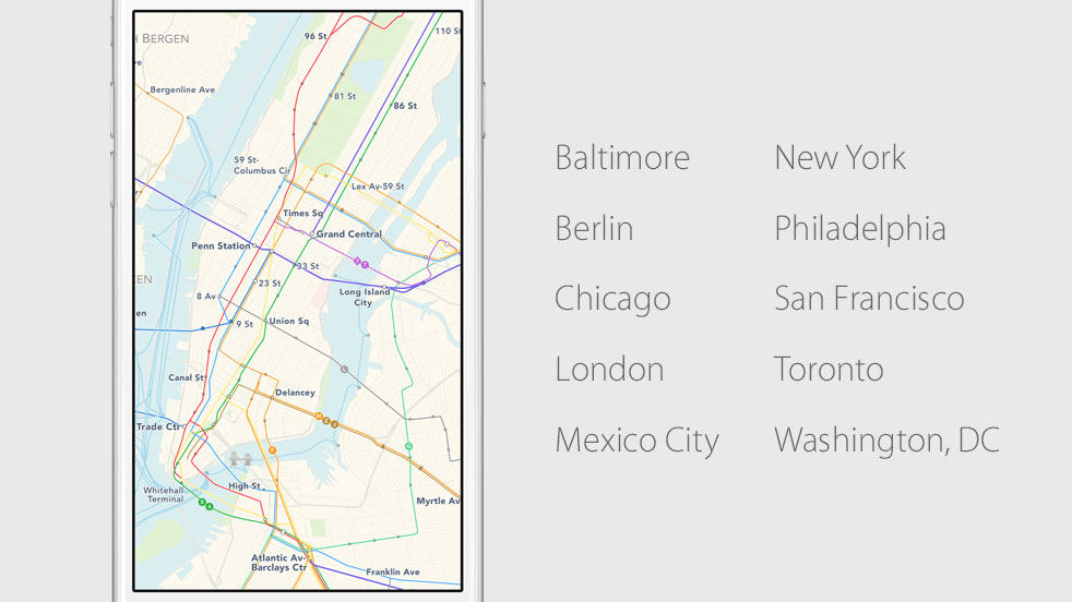
Apple Maps will be rolling out to a select number of major cities throughout the world, including Baltimore, Chicago, New York, San Francisco, Philadelphia, Mexico City and Washington, DC in the United States; Berling in Germany; London in the United Kingdom; and Toronto in Canada.
Last but not least, Apple Maps with transit directions will be available in more than a hundred cities in China, a massive 1.33 billion people market.