Seeing where your iPhone photos were taken on the map can be very helpful! For instance, a few days ago, I was looking for a very specific picture but couldn’t find it in my Camera Roll. Then I remembered that instead of looking for this photo in the Camera Roll, I should look it up by the location where that photo was taken. Indeed, even though I wasn’t sure on what day I had taken this pic, I knew exactly where I took it.
With that information in mind, I was quickly able to pull up that photo on a map, thanks to a neat little feature of the Photos app, assuming, of course, you allow the Camera app to use your location and tag your photos with GPS coordinates.
Not only viewing your photos on a map can be helpful, but it is also a nice way to “travel” to all these places you visited.
In this post, we’ll show you three ways you can visualize the location where your photos were taken directly from the Photos app or from a third-party application.
How to view all your iPhone pictures on a map
This method lets you view all of your photos on map:
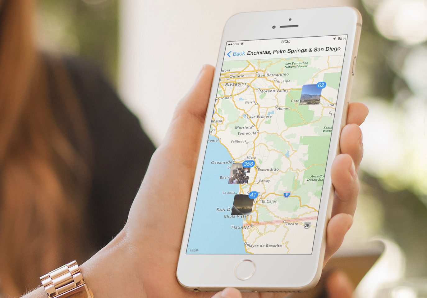
- Launch the Photos app, and go to the Albums tab.
- Look for the album called Places and tap it.
- This will bring up Apple Maps, with stacks of photos placed on the various location where they were taken. You can then tap on each stack to see those photos. Obviously, you can always zoom in and out on the screen to view photos from different locations.
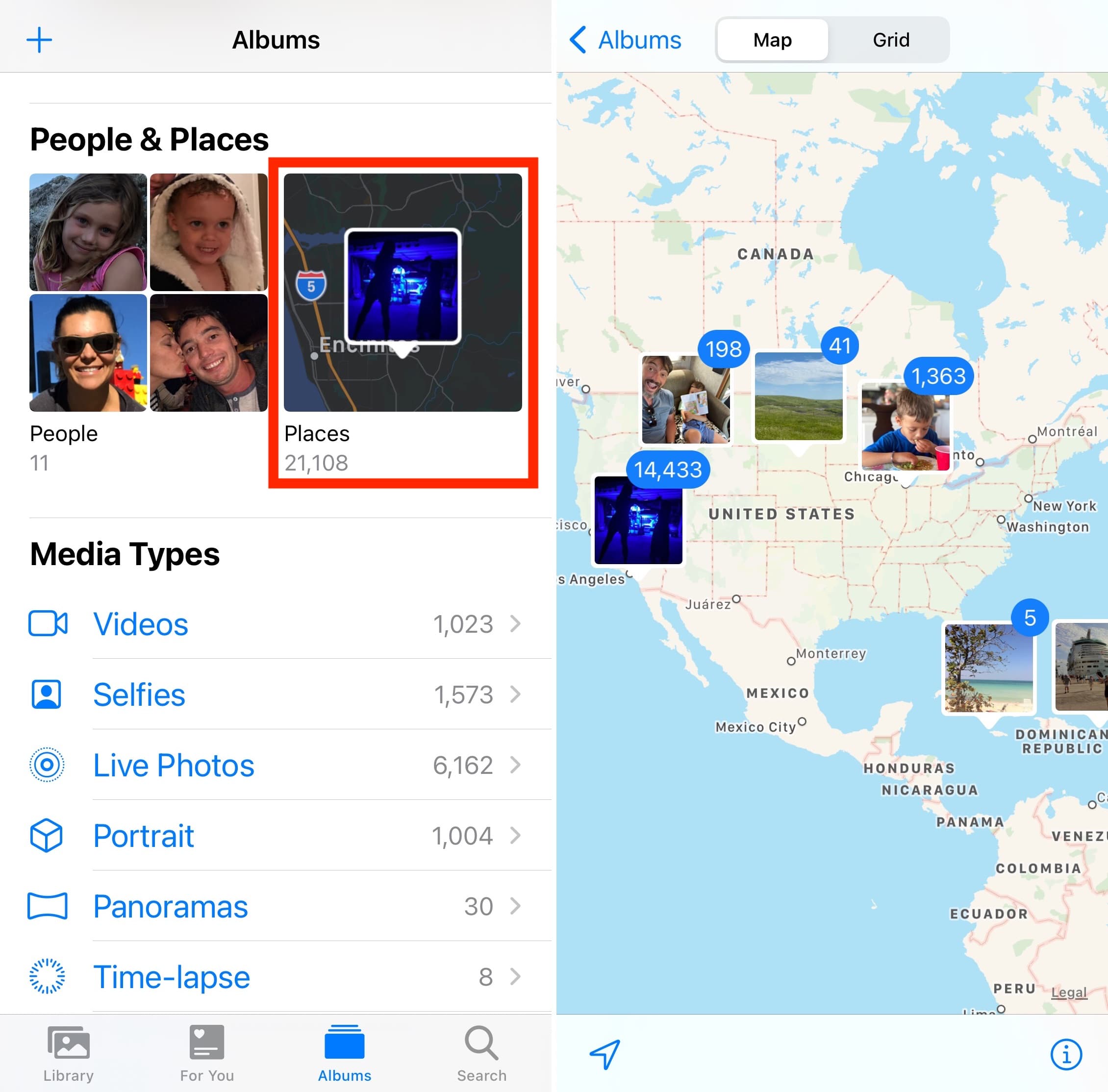
If you use iCloud Photos, or if you have a large collection of photos taken over the course of several years and locations, this feature is a nice way to travel back to the different places you went to.
How to see where one specific photo was taken
This method lets you see one specific photo on a map:
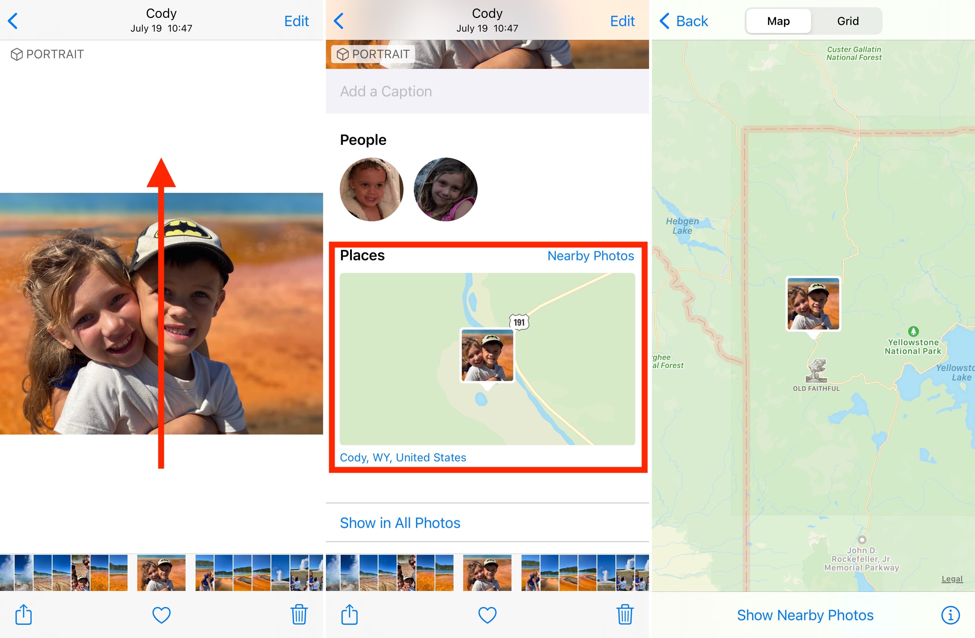
- Go to the Photos app and tap the photo you want to locate on a map.
- Swipe up on that photo to reveal additional information. Here, you’ll see a tile that displays your photo on a map.
- Tap on that map to go full screen and get a better idea of where this place is.
How to see the exact address where a photo was taken
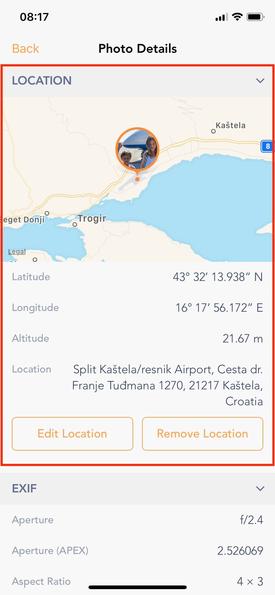
While the two methods above are helpful for getting a general sense of where your iPhone photos were taken, they won’t give you exact location data. For that, you need an app like the one we developed in-house called EXIF Metadata.
- Download EXIF Metadata from the App Store for free.
- Launch the app and select a photo from your library.
- The app will show a map of where the photo was shot, but most importantly, it will show the GPS coordinates, altitude, and address (when available).
If you haven’t yet, check out your photos on a map. As I said before, this is a great way to travel back to the places you visited and bring back nice memories.
Check out next: