Maps+ is a new app, by IZE, that offers a more robust Google Maps experience than the native Maps app on the iPhone. With Maps+, you have more control and customization over your Maps experience on iOS.
The app goes beyond what the stock Maps app has to offer with features like a powerful location tracking tool and social media integration. More details after the break!

Some notable features:
– Swipe with 3 fingers up/down on the map to change quickly between the map types.
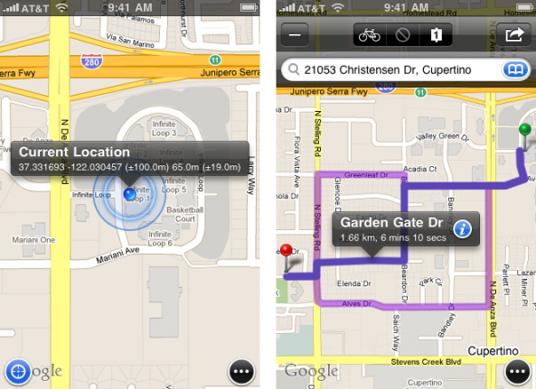
– Tap on your current location to get more info about your location fix: coordinates, horizontal accuracy, altitude and vertical accuracy.
– Get online route directions with alternatives. Add transit points to your routes and get bicycling directions (US only), too.
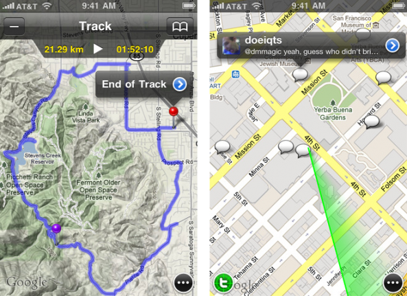
– Record and edit GPS tracks (available on devices with GPS).
– Use location based alarms to remind yourself of tasks that are location specific (e.g. to get off at a train station).
– Find out what people tweet around you and engage with them in a conversation. Log in to Twitter to view your friends’ tweets on the map.
– Add labels to your bookmarks (alarms, pins, routes, tracks).
– Export your bookmarks (alarms, pins, tracks) to GPX via mail or iTunes.
– Import bookmarks by opening a GPX file with Maps+ using Safari, Mail or any other app that supports quick look.
– Simple and clean user interface: all features can be accessed via 1 button. You can put buttons on the map for those features that you use frequently.
Maps+ offers you customizable and draggable pins for certain features that can be added to the main map window. You are given a list of options to choose from, and you can assign and rearrange pins to fit your habits in the app.
Like the default Maps app, Maps+ has all of the same features, like tracking, directions, search, etc. I like the way Maps+ handles dropping pins, and the distance tracking feature is particularly helpful. Location-based alarms can bet set to notify you of when you get near a bookmarked location.

Another interesting feature is the Twitter integration, which allows you to see tweets from your friends and where they’re coming from on the map (assuming the tweets are posted with geo-location turned on). It almost works like a full Twitter client, expect displayed in a map.
One thing I will point out is that I didn’t particularly like the method for getting and following directions in Maps+. It seemed a little unintuitive. Maps+ requires a slight learning curve, but once you figure out the right setup for you, the app can be pretty powerful.
Maps+ does have some limitations:
– Labels are limited to 1.
– Pin bookmarks are limited to 3.
– Route bookmarks are limited to 1.
– Route transit points are limited to 2.
– Track bookmarks are limited to 1.
– Track recording is limited to 2 km.
– Alarm bookmarks are limited to 1.
– Importing bookmarks from GPX is disabled.
– Logging in to Twitter is disabled.
But don’t freak out, because these features can all be enabled with a $2.99 in-app purchase.
I’ve been beta testing Maps+ for a couple weeks, and I’m glad to see that the app has finally made it’s way to the App Store. Maps+ is available for free (with a $2.99 in-app purchase to remove limitations).
If you’re a hardcore Maps user on the iPhone, definitely give Maps+ a try.
What do you think of Maps+? Do you prefer other apps to replace the Maps app on the iPhone?
